Canada WMS Layers
There are a number of WMS layers available for Mapping in Canada
National WMS Layers
NRCan CanTopo NTS Grid GeoBase NHN Grid
The NTS GRID with CanTopoGeoTIFF status JOSM WMS Layer. This is usefull for a quick-reference to see what tile your working in. Also, when using the Natural Resources Canada CanTopo Geo-referenced GeoTIFF maps, this inficated the tiles which are currently available. here http://wms.ess-ws.nrcan.gc.ca/wms/indexcouverture_cantopo?LAYERS=background%2Creference%2Ccoverage%2Cgrid%2Cboundaries%2Cplacename&VERSION=1.1.0&FORMAT=image/png&SERVICE=WMS&REQUEST=GetMap&STYLES=&EXCEPTIONS=application%2Fvnd.ogc.se_inimage&TRANSPARENT=TRUE&
The 2nd layer, which is set to transparent, id the GeoBase National Hydrography Network (NHN) tile boundaries & water flow. This is needed as it contains the river names, which might not be available with CanVec. JOSM WMS layer http://wms.cits.rncan.gc.ca/cgi/wms_en.cgi?map=/export/wms/mapfiles/rhn/geobase_rhn.map&version=1.1.1&service=WMS&request=Getmap&layer=HYDRO_AGGREGAT&format=image/png&STYLE=default&layers=GEOBASE_RHN_NHN&TRANSPARENT=TRUE&
NRCan Toporama
This is the WMS version of the CanVec data that will become available as .osm files. This is handy because in some cases, tracing the map features is just as easy. (Note: the overall accuracy of the data is similar to that of standard GPS tracks)
The base layer data is available as a WMS Layer, the features on this layer can be used to get details about the water features as well as basic map features. You can download the WMS Layer, that can be used in JOSM. Just copy the link directly.
(less detail, but loads faster) http://wms.ess-ws.nrcan.gc.ca/wms/toporama_en?LAYERS=limits%2Cvegetation%2Cdesignated_areas%2Chydrography%2Chypsography%2Cfeature_names&SERVICE=WMS&VERSION=1.1.1&REQUEST=GetMap&STYLES=&EXCEPTIONS=application%2Fvnd.ogc.se_inimage&FORMAT=image%2Fpng&
Sample JOSM views of Toporama in action
Atlas of Canada
Covering Canada at a 1:1million scale this provides an overview of the National Protected areas. See also Atlas of Canada
Mapnik OSM Background
You can use the familar OpenStreetMap mapnik data as a WMS background. This is VERY helpful as it's an easy way to see what is already in the OSM database, without having to download the data. HOWEVER not all data gets rendered so fast, so make sure to download the area when working on it :)
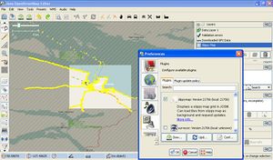
It's a JOSM Plugin, as the screenview shows.
Provincial WMS Layers
Ontario
User:Phurl created a custom WMS layer for Ontario Trails
Local WMS Layers
Using MapWarper small areas can be made available.


