Toronto harbour
| V・T・E |
| latitude: 43.6327, longitude: -79.3718 |
| Browse map of Toronto Harbour 43°37′57.72″ N, 79°22′18.48″ W |
| Edit map |

|
|
External links:
|
| Use this template for your locality |
Toronto Harbour is a town in Ontario, Canada at latitude 43°37′57.72″ North, longitude 79°22′18.48″ West.
What's this?
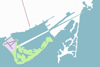
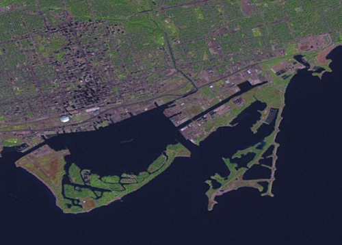
It is a first effort at rendring the Toronto Harbour after the coastline uploads. After the Almien coastline scripts I've deleted many of the points to better follow the landsat image. I've also removed coastline updates where the PGS saw a bridge and drew it as coastline. Other sources suggest that there is more to do to make this rendering accurate but until I get some GPS traces this will have to do.
What have I done ?
Lake Ontario
Only this portion of Lake Ontario will render. Several of the shore ways were selected along with a constructed bounding box for the rectangular sides. This was all tagged natural=water to get the blue fill. That left the city (north) plain white. Good enough for now.
Island Airport
The runways are layer=3, the infield is landuse=industrial and layer=2.
Toronto Islands
The islands are layer=2 and leisure=park to make them green. At least two problems. Firstly, not all of the island area is actually park and this should be divided when good traces and observations are available. Secondly, the park extends under the industrial of the airport and probably shouldn't. Also, the islands that are green are actually several islands. The landsat images don't provide enough resolution separate them properly.
That laser beam
What on Earth is that laser beam thing running from the airport to the north-east? How did I mess that up? (no segments or ways appear in josm for that item)
HELP
There are some problems with this rendering. Please make suggestions in this article for fixing this map. General suggestions may help turn this into a general HOWTO.
Landsat says
Landsat says that the harbour looks like this.

