Uk:Featured images/Oct-Dec 2016
Jump to navigation
Jump to search


These are featured images, which have been identified as the best examples of OpenStreetMap mapping, or as useful illustrations of the OpenStreetMap project.
If you know another image of similar quality, you can nominate it on Featured image proposals.
| ← з жовтня по грудень 2015 р. | ← з липня по вересень 2016 р. | з січня по березень 2017 р. → | з жовтня по грудень 2017 р. → |
Галерея зі значними зображеннями, з жовтня по грудень 2016 року
2016, тиждень 40

2016, тиждень 41

2016, тиждень 42
2016, тиждень 43
2016, тиждень 44
2016, тиждень 45
2016, тиждень 46
2016, тиждень 47
2016, тиждень 48
2016, тиждень 49
2016, тиждень 50
2016, тиждень 51
2016, тиждень 52
Деталі та підписи
Тиждень 40 (з понеділок 3 жовтня 2016 року до неділя 9 жовтня 2016 року) [Edit]

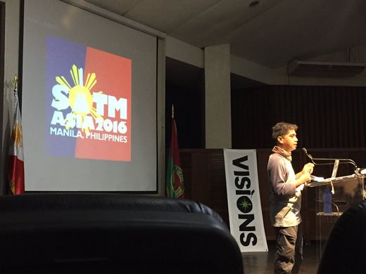
- English : Opening session at State of the Map Asia 2016 in Manila, Philippines last weekend.
Тиждень 41 (з понеділок 10 жовтня 2016 року до неділя 16 жовтня 2016 року) [Edit]

- English : Marco Barbieri presented his cartographic work at OSMit last year, producing these attractive web maps (webmapp.it) and printable tourist maps of Monte Pisano, as well as organising mapping parties in this part of Italy.
Тиждень 42 (з понеділок 17 жовтня 2016 року до неділя 23 жовтня 2016 року) [Edit]

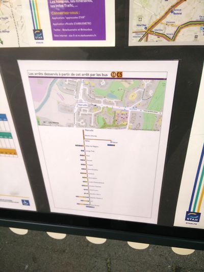
- English : The public transport service STAR in Rennes Metropole, France, uses OpenStreetMap on their information boards.
Тиждень 43 (з понеділок 24 жовтня 2016 року до неділя 30 жовтня 2016 року) [Edit]

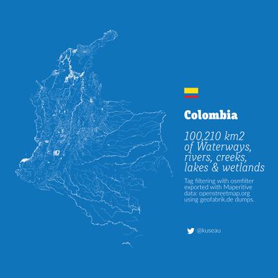
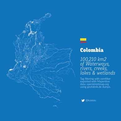
- English : A beautiful image showing all the rivers, lakes, creeks and wetlands of Colombia by Omar Pineda.
Тиждень 44 (з понеділок 31 жовтня 2016 року до неділя 6 листопада 2016 року) [Edit]

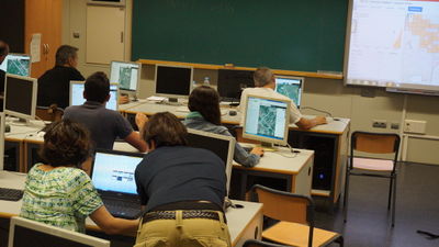
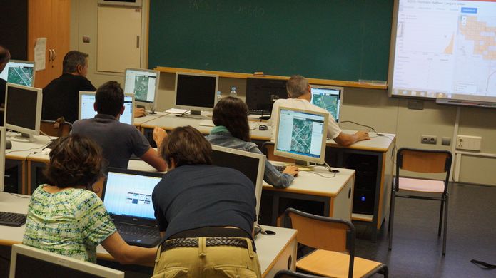
- English : This mapathon in Valencia, Spain, was one of many worldwide disaster response mapping events taking place in response to Hurricane Matthew.
Тиждень 45 (з понеділок 7 листопада 2016 року до неділя 13 листопада 2016 року) [Edit]

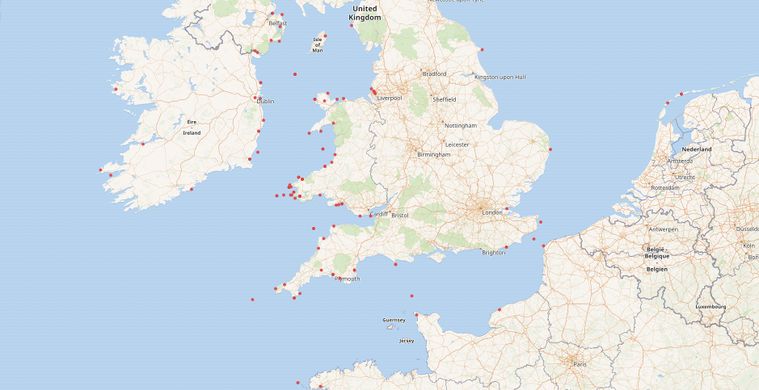
- English : The WikiData project has an eclectic mix of linked datasets and provides a querying interface which can yield a map. This example by Jason Evans shows positions of 19th century Aberystwyth ships wrecked at sea, using data from National Library of Wales and the Ceredigion Archives.
Тиждень 46 (з понеділок 14 листопада 2016 року до неділя 20 листопада 2016 року) [Edit]

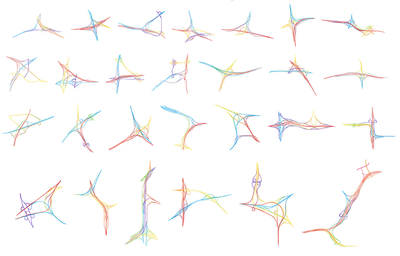
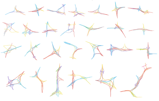
- English : Interchange Choreography by Nicholas Rougeux, is an artistic exploration of major road intersections "Applying colors to roads and using connecting roads to blend those colors".
Тиждень 47 (з понеділок 21 листопада 2016 року до неділя 27 листопада 2016 року) [Edit]

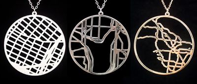
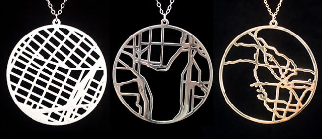
- English : Take open data from OpenStreetMap and have it turned into a stylish and unique pendant on meshu.io!
Тиждень 48 (з понеділок 28 листопада 2016 року до неділя 4 грудня 2016 року) [Edit]

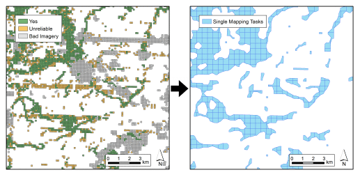
- English : Many people have been classifying imagery in a new super-simple micro-tasking app called MapSwipe. This image illustrates a process developed by DisasterMappers Heidelberg for taking MapSwipe results (left) and setting up a Task Manager project to map the settlements (right).
- українська : Супер-простий додаток Мап-свайп дав сотням людей можливість взяти участь у класифікації супутниковых знімків. На ілюстрації показано, як результат цієї роботи (зліва) перетворюється на набір завдань з картирування поселень (зправа). Алгоритм розробили волонтери з співтовариства Дизастерс-маперс у Гейдельбергу.
Тиждень 49 (з понеділок 5 грудня 2016 року до неділя 11 грудня 2016 року) [Edit]

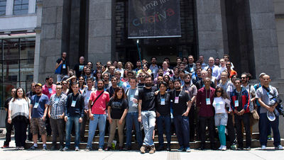
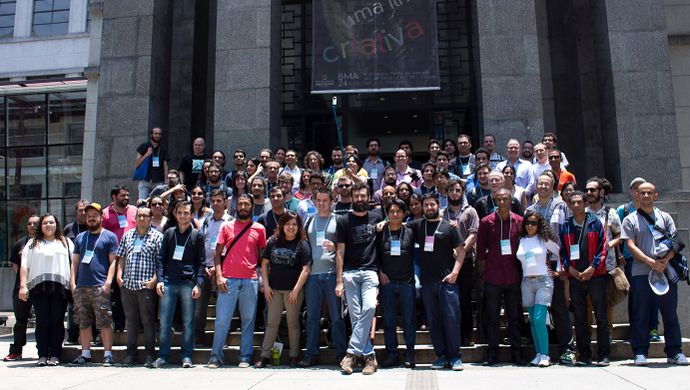
- English : State of the Map Latam 2016, the conference for Latin America, took place last week in São Paulo.
Тиждень 50 (з понеділок 12 грудня 2016 року до неділя 18 грудня 2016 року) [Edit]

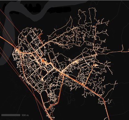
- English : Local volunteers trained by the American Red Cross have mapped 7,000 villages in the border regions of Liberia, Guinea, and Sierra Leone. A total of 70,000 kilometres of roads and paths, including this example, Forécariah in Guinea.
Тиждень 51 (з понеділок 19 грудня 2016 року до неділя 25 грудня 2016 року) [Edit]

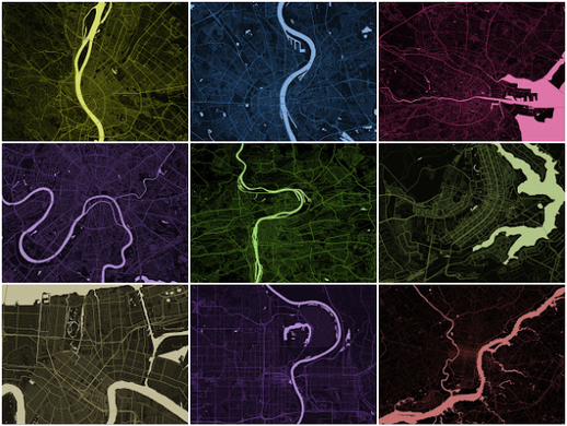
- English : These stripped down maps elegantly characterise world cities by highlighting the shape of water features. They were created by Alex Szabo-Haslam and recently featured in a guardian cities quiz. How many do you recognise?
Тиждень 52 (з понеділок 26 грудня 2016 року до неділя 1 січня 2017 року) [Edit]

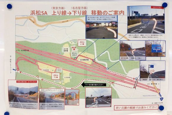
- English : A poster about how to make a U-turn at Hamamatsu highway service area, made by the Shizuoka prefecture, Japan.