User:Bgirardot/Tasking Manager Default Roads, Buildings, Waterways Instructions
Jump to navigation
Jump to search
Mapathon Project for
please only map as part of that event
Project Specific Mapping Notes
=========================
* Many of these squares will already be partially or fully mapped, map in more if needed or fix up the existing mapping, or just mark it "Done" if it is already complete.
* Please connect up roads that are not connected to the main network or nearby roads.
* Please disconnect roads that are attached to landuse=residential areas and draw them into the settlements and connect them to other roads that enter the settlements
* **Existing mapping does not match imagery** - This happens in some areas. Use the Bing imagery, but adjust it so it aligns with the existing mapping, then continue mapping. Please leave a comment in the Tasking Manager when you mark done/stop mapping to say you adjusted the imagery. [Animated GIF how to adjust background imagery in iD](https://goo.gl/photos/77w8e1HjcEXPJEoL9)
* Waterways are challenging in this area, more need to be mapped, but please only map the streams and rivers
* Many of the buildings are round huts. In the iD editor draw a 3 pointed triangle the size of the hut, then select it, hit the 'o' key and it will turn round. Tag it a building and then you can copy/paste it to other huts of the same size quickly.
* [A 5 minute video that uses iD to edit most of the above points for this mapping project](https://youtu.be/MFcHCvuxxvw)
Imagery
==========
* **You will have to align the imagery to the existing mapping**
* Please use "Esri World Imagery" imagery (it should load automatically) (Not the "clarity" beta layer, just "Esri World Imagery".
* You can also look at the Bing imagery, it is a bit more clear, but older, try to map only from Esri.
* **You will have to align the imagery to the existing mapping** See below how to do this in iD. This is the most difficult part of this project.
Roads and Paths
==============
* Please map roads and major paths as completely as possible by connecting them to the main road networks where ever possible.
* Very short segments that do not connect to anything should not be mapped.
* Short segments of a road or path that you cannot see through the trees but seem very likely to exist should be mapped to keep the road complete
* Try and map a little beyond your task square so the person who maps the task square next to yours can easily connect them.
* Always connect roads to other roads where they meet and never end roads on Residential area polygon edges.
You will most often use the following road classifications (JOSM):
* **highway=unclassified** - This is for roads that a vehicle with 4 wheels could travel on that connect small villages and settlements
* **highway=residential** - These are roads that are in settlements that only are used for access to houses and buildings.
* **highway=track** - This is for roads that a 4 wheel vehicle or farm tractor could travel on and only lead to farm fields or forests. They do not connect settlements.
* **highway=path** - This is for small paths that a 4 wheeled vehicle could not travel on and are usually used by people on foot or 2 wheeled vehicles. They may or may not connect settlements or lead to farm fields. Only map the major paths that connect to settlements or other roads.
You will most often use the following "Road Features" and "Path Features" (iD Web Editor):
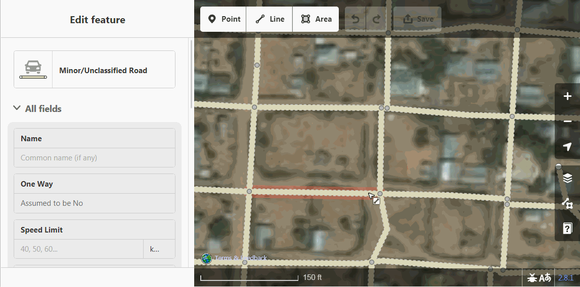
* **Minor/Unclassified** - This is for roads that connect small villages and settlements
* **Residential Road** - These are roads that are in settlements but only are used for access to houses and buildings.
* **Unmaintained Track Road** - This is for roads that only lead to farm fields or forests. They do not connect settlements or residential areas.
* **Path** - This is for small paths that are usually used by people on foot or 2 wheeled vehicles. They may or may not connect settlements or lead to farm fields. Only map the major paths that connect to settlements or other roads.
Buildings
=======
* Please accurately outline all the buildings you can find. The outline should be for the full size of the building even if it is partly covered by trees in the imagery.
* Take care to not include the building shadow in the building outline.
* After drawing the outline and tagging as a building, **use the 's' key in the iD web editor to "square" the corners**.
* Many buildings are very close, but do not actually touch each other, try to map them close to each other without letting them connect or share nodes with each other, roads or residential area outlines. In the iD web editor, holding down the "alt" key will keep nodes from "snapping" to each other and accidentally connecting.
* In the iD web editor, the first time you map a building you will use the "Building Features" category and then at the top of the list select "Building" again, this is the most generic building tag we can use as we almost never can tell the more specific use of any building from imagery alone.
**Only if you have personal knowledge of a building**, please add that information to the building, like the name or type of building (hospital, school, gas station, etc)
Residential Areas
==============
* Please draw one large area outline around groups of buildings and tag them **landuse=residential**
* About 5 or more buildings can be outlined as a landuse=residential area.
* Do your best to keep the outline close to buildings and not include a lot of farmland or forest.
* When to draw the residential area outline takes some judgement, but when in doubt, draw an outline around the settlement.
Open Areas
===========
* **leisure=common** - Open flat areas of grass or dirt in a settlement, often with paths across them
* **leisure=pitch** - An identifiable sports field of some sort, usually football/soccer, baseball
* **leisure=park** - An open area that you personally know to be an official park or recreation area
* **landuse=grass** - Open, flat grassy area, not a farm field or crops.
Waterways, Bridges, Fords, Dams
===========================
* **waterway=stream**
* **waterway=river** - If you see obvious waterways, please map them. They are usually much lighter color, grey than roads/paths and you can often see rocks and split channels. Much like the road system, please find where the waterway connects to the main waterway network and map it to connection. Mapping waterways implies a direction as well so zoom out, look for already mapped waterways nearby, or use the OpenCycleMap background layer to help determine which direction the water flows.
* **bridge=yes** - This tag is placed on a segment of road that is just the same size as the bridge and also needs a tag that says **layer=1** to indicate it is above the waterway. *The waterway and the road do NOT share a node.*
* **ford=yes** - If you see a road crossing a waterway try to confirm a bridge or a ford. Fords are places where the road just drives through the waterway. To map a ford, have *the waterway and the road DO share a node* and put the ford=yes tag on that one single node.
* **waterway=dam** - Dams are a little confusing to map, please see the references listed below and ask a more experienced mapper to help you. But they are important to map if you can identify them.
General Mapping Notes
====================
* **Be as precise as possible** - This takes a little bit of practice, but following a road closely or the outline of a building carefully really makes a difference in the quality of map data produced. Quality is more important than quantity when it comes to mapping. Zooming in close helps.
* **changeset comments** - These are filled in with some default information but you should always add what you mapped. For example "added buildings and roads" or "added in some waterways"
* **It is ok to "split" task squares** - Sometimes a task square will have a lot detailed settlement mapping. If you think it would help to make the task square smaller so the mapping could be finished in a more reasonable time, use the "split" link above the task square comment box.
* **Personal knowledge** - If you have local knowledge, that is incredibly valuable and any information you are 100% sure of you can add to the object you are mapping. Building names, health facilities, names of roads, etc, are all very valuable and the name= tag can be used to supply that information.
* **Sometimes a task square is already mapped** - Sometimes you will find a task square that looks totally mapped or has nothing in it to map. Just double check that it is complete, map anything that was missed, straighten up anything that needs it and then mark it "Done".
* **Invalidated task squares** - You might get a notice that a task square was "invalidated" that almost always just means someone found a few more things to map and they did not have time to map them in. No worries, it is part of the process and happens all the time. **If you have to stop mapping before you have mapped everything use the "Unlock" link instead of "Done"** As long as you are trying to map everything in a task square you feel confident mapping before you mark one "Done" then all is good.
* **Ask questions** - if you have questions, please ask. The front page of this [HOT Tasking Manager](http://tasks.hotosm.org/) website offers a few ways to ask or if you are at a mapping event, raise your hand and ask.
* **You are making a real difference mapping** - Every contribution matters in a real, tangible way. Mapping in not easy but know that your mapping is used by humanitarian organizations around the world every single day.
References
==========
The OSM Wiki is where you can find detailed information on how to tag objects, below are some of the most relevant pages to typical humanitarian mapping projects.
* [Naming Guidelines https://wiki.openstreetmap.org/wiki/WikiProject_India#Naming_in_different_scripts_and_languages]
* [Highway Tag India- An excellent guild to typical humanitarian road mapping](https://wiki.openstreetmap.org/wiki/India:Tags/Highway)
* [Highways, Roads, Paths - More than you want to know](http://wiki.openstreetmap.org/wiki/Key:highway)
* [Waterways](http://wiki.openstreetmap.org/wiki/Waterways)
* [Buildings](http://wiki.openstreetmap.org/wiki/Key:building)
* [How to Map a Dam](http://wiki.openstreetmap.org/wiki/Tag:waterway%3Ddam)
How to change and adjust background imagery in iD
=============================
You can select between Esri World Imagery and Bing in the same place you align the imagery to the existing mapping. When the task first open Esri World Imagery has been put in the Custom field for you, but it is the same as the "Esri World Imagery" imagery in the list.
Below is a demo of someone adjusting the background imagery alignment. They are left clicking in the grey box and holding and dragging the mouse and the imagery is moving as the hold-drag the mouse.
Roads Improvement Project Specific Instructions
================================
`Only for LOCAL or EXPERT JOSM MAPPERS 1 year or more mapping experience only`
`These projects do not need task squares validated - This project **is** validation on existing mapping, one pass only`
* **LOCAL Mappers who might add street names must review [Naming in different scripts and languages](https://wiki.openstreetmap.org/wiki/WikiProject_India#Naming_in_different_scripts_and_languages) first**. Only local mappers should be naming streets and must follow those guidelines.
* The most recent imagery is DG Premium and DG STandard, DG Premium to zoom level 17 is newest, switches to older imagery zoomed past 17
* Please add missing roads. Most will be "unclassified"
* Do not map tracks, only residential, and unclassified, most will be unclassified in the rural areas.
* These are very large Task squares, you might need split if you can not download all the OSM data, always download all the data, not just highway data.
* Before saying the square is done, run JOSM validation and please fix only easy to fix road network issues you did not map. This is a main focus of the project, quickly fix easy to fix road network issues and fill in missing roads.
* Please do not change any road classifications or other information, especially roads higher than unclassified. You can fix highway=road warnings, if you want.
* Upload often you data often to help avoid edit conflicts
* Avoid adding or removing nodes on exiting highways, this will reduce conflicts, but can not be avoided for lots of fixes like bridges or fords
* Always respect existing mapping. Please do not change anything but easy, obvious fixable things. Leave anything you do not understand.
* Try to pick task squares where no one else is working next to it. Spread as far apart checking out Task Squares as possible
#### Most common JOSM validation errors and warnings to fix.
The below are quick and easy to fix and have a big impact on the overall function of the road network. You will be ignoring the vast majority of the JOSM errors and warnings and only focusing on the road related errors or warnings. Never try to fix something you do not 100% understand or use the built in "Fix" button in JOSM. You must fix these by hand only please.
* Error - Duplicated ways
* Error - Highway Duplicated Nodes
* Warning - Crossing Building / Highway
* Warning - Crossing Highway / Waterway
* Warning - Crossing Highways
* Warning - Overlapping Highways
* Warning - Overlapping Ways
* Warning - Self intersecting ways
* Warning - Way End Node Near Other Highway
* Warning - Way End Node Near Other Way