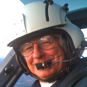
User:CaptainKirk
Adding Aviation Features
Thursday September 9th 2010
Just idly adding and editing some aviation features at Yan Airport, KPEO. Runways, taxiways, aprons (aka. ramps in US colloquial usage) and the helipad. These features are from having visited there yesterday.
Mapping from time to time is such a satisfying activity. It's highly recommended.
John Kirk
[http://captainkirksmusings.blogspot.com/ Captain Kirk's Musings
A New User
Having just joined both the map and the wiki, and having been welcomed by an avid user (thank you Harry Wood) who kindly replied to a diary entry I made, I am certainly fascinated by the concept of this project. Being a map user, as an helicopter pilot, and having had a passion for maps, old and new, for many years, the Open Street Map project is just awesome. I am looking forward to becoming an expert user/contributor. Where an entry helps me at work, I shall be delighted. Where I can interact with other users and contributors, even better.
For now, I shall continue my project of tagging a few helipads around the bazaars.
John Kirk
| Babel user information | ||
|---|---|---|
| ||
| Users by language |
The Learning Curve
There's an aphorism that's been around forever that says RTFM. If you don't know what it means, then sorry, it's Read The Flaming Manual. Any wiki includes pages and pages of help, and Open Street Map is no different. So what have I been doing this last hour? Reading, following links, searching the map for the type of entity I'm interested in providing.
What have I learned?
- I can put emphasis on a wiki text, like this.
- I can successfully add a node to the map with as little or as much detail as I wish.
- I have edited my own database to provide latitude and longitude in the correct format to search the map. In case you didn't know it's degrees and decimal degrees, with a minus sign for South and/or West, and separated by a comma. E.G. 42.1011666666667,-76.8261666666667
Helipad uploads continue
So there I am waiting for a call, being attacked by mosquitos, and grabbing data I have on hospital helipads. It takes a few keystrokes, but seems to me to be working. The only tags I am using are aeroway:helipad and name in the format Hospital Name Helipad I am putting the town, county, state, and country in the comments section. I'd appreciate any feedback if more experienced contributors feel that there should be more information on these nodes.
Cheers. John Kirk July 29 2010
iLOE An app for the iPhone
What's new for me? I bought the iLOE application for the iPhone. I uploaded a node using the application, and am quite impressed with its simplicity. The node I uploaded is Toomey's Corner
