User:Ceyockey/Haiti Imagery and Places
Introduction
This page is a manual proof-of-concept related to maximizing the return-on-investment for making satellite imagery available for use in Humanitarian OpenStreetMap Team-coordinated efforts. The problem that this approach addresses is the difficulty in collating lists of places which are covered by available high-resolution imagery in a way that facilitates division-of-labor and elevation of minimum map tracing results for areas which are not designated as top-priority by relief agencies.
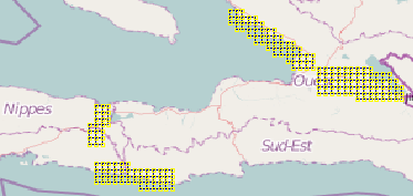
This approach capitalizes on the emergence of gridded .osm files for several imagery coverage areas in Haiti. These .osm files have been provided by User:Crschmidt in late January (see addition diff).
Most elements of the work below could be conducted by automated scripts; this manual activity aims to determine utility and requirement leading up to an automated method.
NOAA-2010-01-20
Section A (West-North)
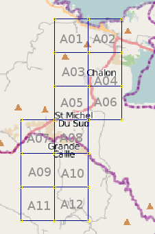
Working with .osm file "noaa-20.1.osm". The image below shows one of four segments of the workspace.
 see OSM Mapper for editing activity over the past month |
|
|
