User:Scoid
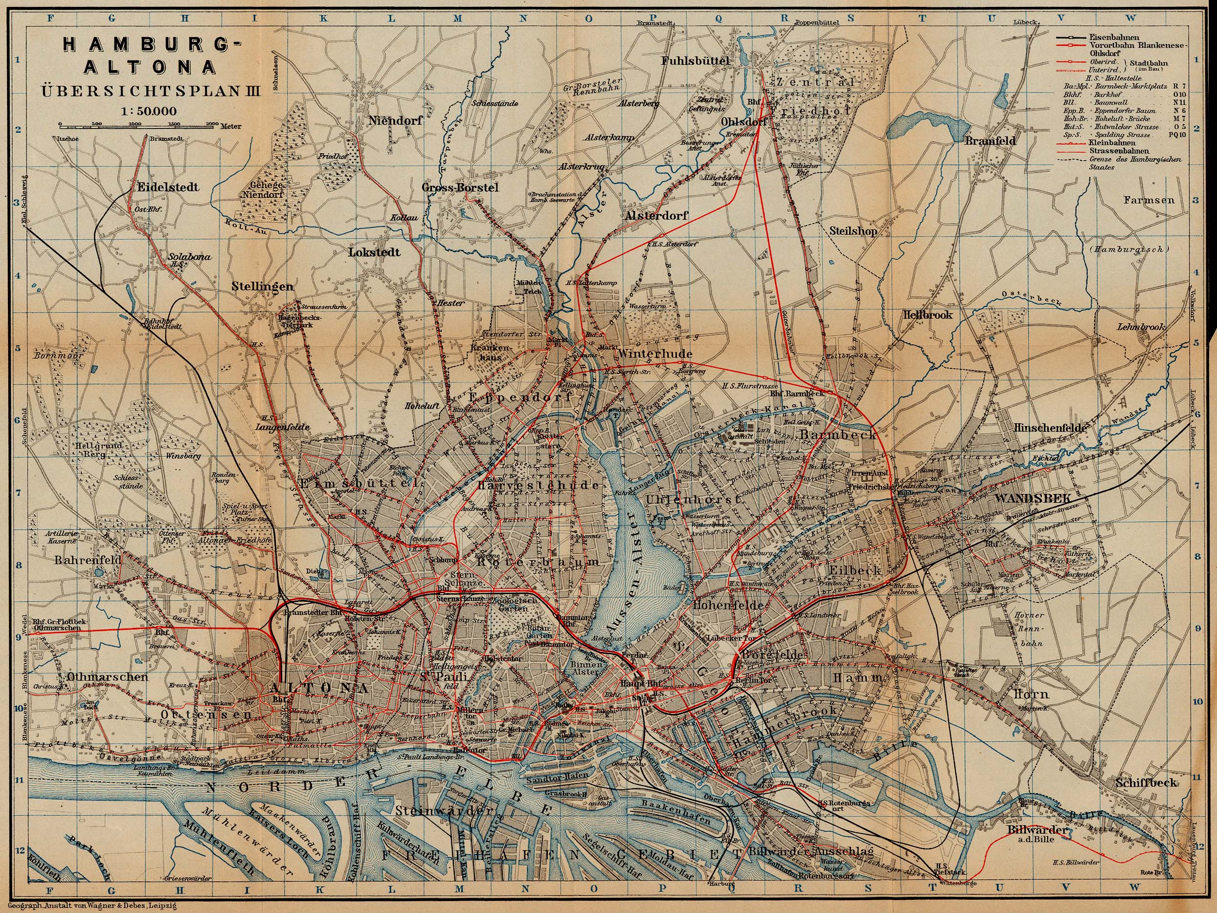
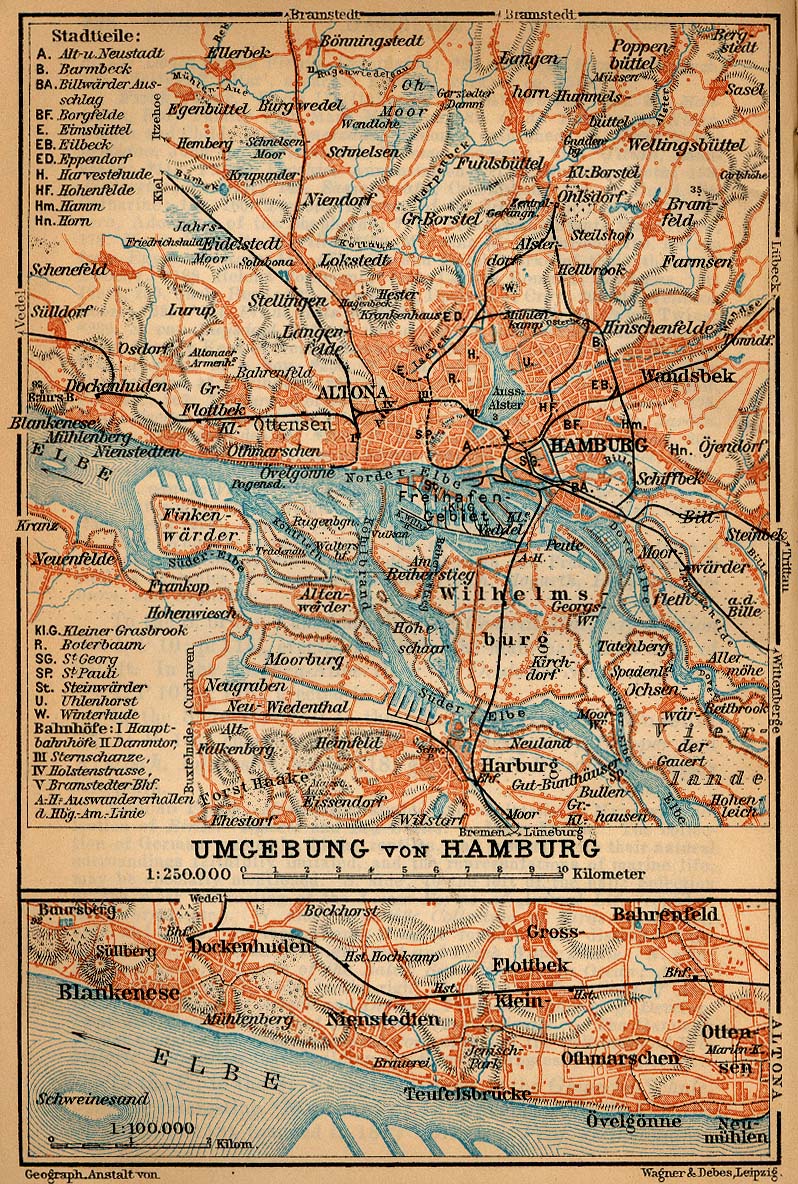
I like this map, looks than someone did it before: http://www.level3.com/europeanmarkets/images/hamburg_map.jpg and this http://www.lib.utexas.edu/maps/historical/baedeker_n_germany_1910/hamburg_rail_1910.jpg http://www.lib.utexas.edu/maps/historical/baedeker_n_germany_1910/hamburg_inner_1910.jpg http://www.lib.utexas.edu/maps/historical/baedeker_n_germany_1910/hamburg_altona_1910.jpg http://www.lib.utexas.edu/maps/historical/baedeker_n_germany_1910/hamburg_environs_1910.jpg
http://tramways.wordpress.com/
feldblockfinder = Der Feldblockfinder ermöglicht es, anhand der Feldblocknummer oder eines Ortsnamens nach Flächen in einem Bundesland zu suchen.
Many citizen's groups need this data, they never otherwise could afford.
I purchased from globetrotter/ Hamburg /Germany: Garmin Geko 201 (€ 144.95) + PC cable for a RS232 (serial) connector (€ 27.95).
Conrad Electronic has 4 x 1,2 Volt NiCad (AAA) 300mAh batteries (€ 4,95) 2 batteries are needed, so you can use the 2 other for charging them. This was the cheapest entry to get into the play.
Platform: Microsoft Windows XP ubuntu
Software on MS Windows: GPSBabel for transferring the data via the RS232 (4800 baud) from the Garmin Geko 201 to the PC.
The Garmin Geko 201 itself is running Software Version 2.60 from Garmin.


While transferring data between the Garmin and the PC there is no explicit indication that uploading is in process, instead you will get a looking glass (after a while, not soon after pressing the button, stay and wait!) and the processor load make your PC roar. Remember it's a RS232 not a USB port. Please stand by up to the appearance of this message box which tells you, that the transfer was successful.

This previous operation results the next file, from which I include a screenshot here. This is a .GPX file just another XML derivate. This one can be opened by any text editor, the example shows a MS Windows application.

current state:

