| Userboxes
|

|
This user submits data to OpenStreetMap under the name
stoecker.
|

|
Stoecker submits data to OpenStreetMap using JOSM.
|

|
Stoecker commits code to OpenStreetMap under the name stoecker
|

|
Stoecker is a biker
|

|
Stoecker
ignores tag voting procedures.
|
|
My name is Dirk Stöcker. I live in Germany and I am a Diplom-Engineer for geodesy.
A little bit more information about me can be found at my homepage.
To satisfy your curiosity, here my mapping equipment:
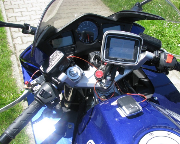
GPS-Logger with Button-Extension
I use an i-Blue 747 GPS receiver and recorder which has a little extension so the button to record POI's can be external.
This external button is placed on the clutch lever of my motorbike (red button).
At the bottom of the receiver two magnets are attached, so the device can be placed on the tank of the bike.
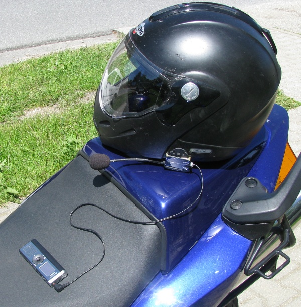
Voice recording
Together with the GPS track I record the texts using a Panasonic RR-US470 (see at Amazon, DE) voice recorder. As I have a TomTom Rider navigation system with headset I made a little adapter to be able to use the microphone of the headset (which has pretty good quality at the rather loud environment of my helmet :-)
How it works:
- Turn on GPS receiver
- Turn on voice recorder (in continous recording mode - no voice activation)
- Press GPS-button and say "Start" at the same time
- Now drive and press the button wehener something interesting comes - talk at the same time about what it is
- When finished download data as GPX and as WAY file
- Open GPS file in JOSM
- Press right mouse on the GPX layer and choose menu point to load audio file
- start audio playback until you hear "Start" text, then stop it (both using the dot on keyboard)
- Press right mouse on the audio layer and choose option to synchronise data
- Now the markers at the map are synchronised with the sound and entering data can start
Works fine. Really.