United States Bicycle Route System
Introduction
Mapping the United States Bicycle Route System (USBRS), now at version 2.3.5 in OSM (incorporating Autumn 2023 AASHTO Approvals). "The USBRS is a developing national network of bicycle routes connecting urban and rural communities via signed roads and trails. Created with public input, U.S. Bicycle Routes direct bicyclists to a preferred route through a city, county, or state - creating opportunities for people everywhere to bicycle for travel, transportation, and recreation. To date, 57 U.S. Bicycle Routes (USBRs) as 29 "core" (1- and 2-digit) routes and 28 spur, belt and alternate (3-digit and "A-suffixed") routes, spanning over 19000 miles† (>31000 km) have been established in 34 states including Alaska, Arizona, Arkansas, California, Connecticut, Delaware, Florida, Georgia, Idaho, Illinois, Indiana, Kansas, Kentucky, Maine, Maryland, Massachusetts, Michigan, Minnesota, Missouri, Nevada, New Hampshire, New York, North Carolina, North Dakota, Ohio, Oklahoma, Pennsylvania, Tennessee, Utah, Vermont, Virginia, Washington state, West Virginia and Wisconsin, as well as the District of Columbia. These routes are selected and maintained by state Departments of Transportation (DOTs), and designated and catalogued by the American Association of State Highway and Transportation Officials (AASHTO)." Source: Adventure Cycling Association (ACA). The fully realized System intends to encompass over 50,000 miles (>80000 km) of routes as USA's officially-numbered national cycling network. ![]() EuroVelo, Earth's current "big dog" wide-area cycling network, continues to grow towards 90000 km.
EuroVelo, Earth's current "big dog" wide-area cycling network, continues to grow towards 90000 km.
† As of January 2024, mileage totals may not update from 19425.2 (the Spring 2023, version 2.3 total) to include final tallies for this Round's additions and realignments (estimated to total 19654 miles); ferry mileage is excluded. Autumn 2023 subtotals are not yet finalized, so version 2.3.5 mileage totals are not "final" but rather stated on ACA's web site as "over 19000 miles."
By using OSM to create high quality maps of this growing network (and wonderful national resource), we can promote its further development and use. OSM is a positive tool for geographic communication of existing and developing bicycle routing at national, state and local levels in the USA!

|
| CyclOSM A free cycle-oriented map with more features than OpenCycleMap. See its wiki page CyclOSM. |
| Waymarked Trails: Cycling by Sarah Hoffman is a layer superimposed over mapnik (Standard Map Layer) which shows marked cycle routes around the world. Updated minutely, it renders actual routes without the state=proposed tag. Therefore no proposed routes (or proposed numbering protocols) are displayed. |
Approved USBRs in OSM
Since July 2013, OpenStreetMap contains all approved USBRs (or endeavors to do so as routes are newly approved by AASHTO). These are tagged with type=route, route=bicycle, network=ncn, ref=USBR # and cycle_network=US:US. In the Cycle Map layer (OpenCycleMap, or OCM), these display as solid red lines badged with red USBR numbers. Cycle Map also displays proposed USBRs (ongoing proposals distinctly moving towards AASHTO application as USBRs — or better, actual USBR applications before AASHTO on its next ballot) as dashed red lines badged with red USBR numbers. The Cycle Map and CyclOSM renderers display both approved and proposed routes, while the Waymarked Trails: Cycling (Lonvia) renderer displays only approved (not proposed) routes. One route relation representing both directions of a USBR is called a "bidirectional" route; most routes are bidirectional, tagged with forward and backward role tags where necessary to express "only-in-this-direction travel." Two route relations for one USBR (one for each direction) are called "unidirectional." Bidirectional USBRs which traverse a single US state are expressed with a single type=route relation. USBRs which traverse multiple US states (and those which are unidirectional) are expressed as a super-relation (here, a type=route relation containing only other type=route relations). If routes are bidirectional members of a super-relation (one route traversing multiple states), add name=# (Name of state) (where # is USBR number) to each bidirectional member relation, to better distinguish them. If routes are unidirectional and in multiple states, add name=# direction (Name of state) (where direction is [north, east, south, west]). Largely because of disparities in state funding levels, on-the-ground USBR signage improves patchily across the System; about 1/4 of the miles in the System are signed, with either a green or black shield (MUTCD M1-9, see below) plus sometimes a cardinal directional sign (MUTCD M3-1, M3-2, M3-3 or M3-4). Big thanks to Minh Nguyễn (talk, contribs) for updating the green and black .svg graphics of the shields and tracking which states and routes use which shields (detailed!). Note that as of 2024-Q2, the IA-15 (Interim Approval) naming reduction in Wikipedia (to M1-9) remains under completion (MUTCD re-adopts for 2024, re-naming conventions requested, going through Wikipedia channels); this results in a handful of shields below being not-yet-updated.
The great majority (87.8%) of USBRS mileage is fully paved. Notably, USBR 50's segments of both the Great Allegheny Passage (GAP) and the C&O Towpath along the Potomac River are unpaved. As of Spring 2023 USBRS' "trail" subtotal (including C&O and GAP) was 2,370 miles, representing the unpaved remaining 12.2% of the System's mileage.
OpenStreetMap in the US also contains several significant national-scope bicycle routes (which display in OCM as solid red lines badged with red route acronyms), not strictly part of the USBRS: East Coast Greenway (ECG, which both shares and diverges from segments of USBR 1), Mississippi River Trail (MRT, identical to USBR 45 & 45A in Minnesota), Western New England Greenway (WNEG, identical to USBR 7), International Selkirk Loop (ISL), 9-11 Trail, (9-11, in six mid-Atlantic states and DC), Natchez Trace Parkway (in three southern states) and Grand Rounds Scenic Byway (GR) around Minneapolis, Minnesota, tagged cycle_network=US:MN:MPRB, designated a National Scenic Byway (NSB) by the US Secretary of Transportation. ECG and MRT traverse several states over several thousand miles/kilometers. Hence, these two quasi-private (neither government-sanctioned nor approved by AASHTO, but public data) bicycle routes are determined to be so "national in scope" in the USA that their inclusion in OSM's national cycleway network is asserted as named (not numbered) quasi-national network=ncn routes. WNEG is a third such quasi-national route: while shorter than ECG and MRT, WNEG connects Canada to the Atlantic Ocean at ECG. ISL crosses the Canadian border and is tagged as two separate relations, one tagged cycle_network=ISL and a USA-only relation tagged cycle_network=US, so ISL is "both" international (via its network=icn tag) and quasi-national (via the separate USA-only relation). network=icn does not render in OCM, but does render in Waymarked Trails: Cycling. 9-11 National Memorial Trail links three memorial sites from New York to Virginia to Pennsylvania. Natchez Trace Parkway NTP, traverses 714 km / 444 miles through Alabama, Mississippi and Tennessee, the United States' Department of the Interior's National Park Service manages this "mixed use" national resource. Grand Rounds Scenic Byway System (GR) around Minneapolis, Minnesota, tagged cycle_network=US:MN:MPRB is designated a National Scenic Byway (NSB) by the US Secretary of Transportation (who also designates as NSB "All-American Roads"; other NSB cycleways similarly entering OSM grow into this quasi-national categorization and so may also be tagged with network=ncn). Quasi-national routes tagged cycle_network=US, ECG, MRT, WNEG, ISL, 9-11 (as cycle_network=US:USA), NTP (as cycle_network=US:NPS) and GR (as cycle_network=US:MN:MPRB) exist alongside USBRs (as cycle_network=US:US) in OSM's national bicycle route hierarchy, but are not USBRs (except for USBR 45 and 45A in Minnesota, which are "both" USBRs and part of MRT, noting that USBR 7 is identical to WNEG and 9-11 Trail overlaps other USBRs plus ECG in places). "9-11" and "9-11 NMT" are defined as alphanumeric or acronymic, not numeric (as these are found as USBR ref=*s).
It is easy to see if a USA national-scope bicycle route is national or quasi-national: national routes (USBRs) display red numbers in their OCM shields, while quasi-national routes (ECG, MRT, WNEG, ISL, 9-11, NTP, GR...) display red acronyms in their OCM shields. And again, (numbered) USBRs are tagged cycle_network=US:US.
If you seek to download USBR GPX files, thanks to ACA who offer these for free download via RideWithGPS (and have no objection to our link). See some historical Discussion about this. Gigantic thanks to Kerry Irons of Adventure Cycling Association, without whom OSM would not have the System we do today.
Here are current approved USBRs in OSM:
| Route | Relation | State(s) and notes | Shield(s) |
|---|---|---|---|
| United States Bicycle Route 1 | 3022887 |
Maine, New Hampshire, Massachusetts (Phase I and II segments), Maryland, District of Columbia, Virginia, North Carolina, Georgia, Florida. | .svg)  |
| United States Bicycle Route 1A | 1770834 |
Maine | .svg) |
| United States Bicycle Route 7 | 6296991 |
Vermont, Massachusetts, Connecticut. A fully completed route in the System. Co-branded as / identical to "Western New England Greenway," signage is M1-8 as indicated to the right. | .svg)  |
| United States Bicycle Route 10 | 4274011 |
Washington, Idaho, Michigan (current western terminus in Iron Mountain does not quite reach Wisconsin. Michigan DOT notes it is working with Wisconsin DOT to extend to Wisconsin). | .svg)  |
| United States Bicycle Route 11 | 12126554 |
New York, Pennsylvania, West Virginia, Maryland | .svg)  |
| United States Bicycle Route 15 | 8257568 |
Georgia, Florida. Both states are 100% complete, though as entered now both benefit from a "double-check review." (Please "sign and date" this (using four ~ characters while editing wiki) when completed, then remove this comment after completing review). USBR 15 in Georgia was OSM's first entered as unidirectional: other routes are bidirectional unless their Relation cell is green. Any new USBRs created in OSM as a super-relation containing two unidirectional routes (per state) should also follow this "Relation cell green" convention in this wiki. This USBR is in both states (all states containing the route), so the Relation cell is green. | .svg)  |
| United States Bicycle Route 20 | 13084080 |
Washington, Minnesota, Michigan. (Minnesota co-brands USBR 20 as Prairie Lakes Route, although, signage is M1-8 as indicated to the right). | .svg)  |
| United States Bicycle Route 21 | 8852715 |
Ohio, Kentucky, Tennessee, Georgia. A fully completed route in the System. |  |
| United States Bicycle Route 23 | 8832289 |
Tennessee, Kentucky |  |
| United States Bicycle Route 25 | 12922795 |
Ohio |  |
| United States Bicycle Route 30 | 11527029 |
North Dakota, Wisconsin, Ohio, Pennsylvania | .svg)  |
| United States Bicycle Route 35 | 5552019 |
Indiana, Michigan |  |
| United States Bicycle Route 36 | 5552101 |
Pennsylvania, Illinois, Indiana | .svg)  |
| United States Bicycle Route 37 | 3783539 |
Illinois |  |
| United States Bicycle Route 40 | 12916369 |
Washington | .svg) |
| United States Bicycle Route 41 | 6708256 |
Minnesota (Minnesota co-brands USBR 41 as North Star Bicycle Route, although, signage is M1-8 as indicated to the right) | .svg) |
| United States Bicycle Route 44 | 12925038 |
Ohio |  |
| United States Bicycle Route 45 | 15976701 |
Minnesota (Minnesota co-brands USBR 45 as Mississippi River Trail) |  |
| United States Bicycle Route 45A | 15754250 |
Minnesota (Minnesota co-brands USBR 45A as Mississippi River Trail). Signage is "MRT" plus an "ALT" or "ALTERNATIVE" plaque. | |
| United States Bicycle Route 50 | 2532740 |
District of Columbia, Maryland, Pennsylvania, West Virginia, Ohio, Indiana, Nevada, California. Segments, including the Great Allegheny Passage (GAP) and the C&O towpath along the Potomac River are unpaved. | .svg)  |
| United States Bicycle Route 50A | 2532436 |
Ohio |  |
| United States Bicycle Route 66 | 8498552 |
Missouri, Kansas, Oklahoma, California | .svg)  |
| United States Bicycle Route 70 | 5167193 |
Utah |  |
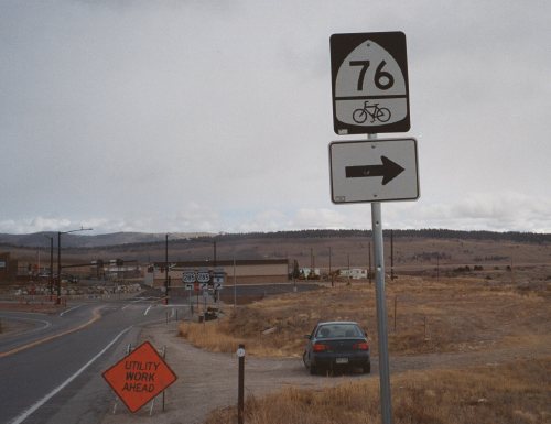
| United States Bicycle Route 76 | 3019665 |
Virginia, Kentucky, Illinois, Missouri, Kansas | .svg)  .svg) |
| United States Bicycle Route 77 | 12602792 |
Utah |  |
| United States Bicycle Route 79 | 5167233 |
Utah |  |
| United States Bicycle Route 80 | 14607447 |
Arkansas | .svg) |
| United States Bicycle Route 81 | 12916368 |
Washington | .svg) |
| United States Bicycle Route 87 | 7644264 |
Alaska, Washington | .svg) |
| United States Bicycle Route 90 | 16808950 |
Florida, Arizona | .svg)  |
| United States Bicycle Route 90A | 4264419 |
Florida | .svg) |
| United States Bicycle Route 95 | 7644263 |
Alaska, Washington, California (The northern part of California, from Oregon to the north city limit of Pacifica). | .svg) |
| United States Bicycle Route 97 | 7644262 |
Alaska, Washington. | .svg) |
| United States Bicycle Route 110 | 6575317 |
Idaho |  |
| United States Bicycle Route 121 | 15661076 |
Tennessee | |
| United States Bicycle Route 176 | 6313585 |
Virginia |  |
| United States Bicycle Route 187 | 16622826 |
Alaska | |
| United States Bicycle Route 201 | 11642110 |
Delaware, Maryland |  |
| United States Bicycle Route 210 | 6575318 |
Idaho |  |
| United States Bicycle Route 221 | 5518310 |
Georgia |  |
| United States Bicycle Route 230 | 12925019 |
Ohio. There is also a USBR 230 in Wisconsin. |  |
| United States Bicycle Route 230 | 10967108 |
Wisconsin. There is also a USBR 230 in Ohio. | |
| United States Bicycle Route 235 | 12925064 |
Indiana |  |
| United States Bicycle Route 281 | 12916367 |
Washington | .svg) |
| United States Bicycle Route 310 | 8284778 |
Washington |  |
| United States Bicycle Route 387 | 16622979 |
Alaska | |
| United States Bicycle Route 397 | 1770863 |
Alaska | |
| United States Bicycle Route 410 | 6575319 |
Idaho |  |
| United States Bicycle Route 421 | 5518364 |
Georgia |  |
| United States Bicycle Route 501 | 10215566 |
Maine | .svg) |
| United States Bicycle Route 587 | 16623026 |
Alaska | |
| United States Bicycle Route 610 | 15754755 |
Idaho. There is also a USBR 610 in Washington. |  |
| United States Bicycle Route 610 | 8284844 |
Washington. There is also a USBR 610 in Idaho. | |
| United States Bicycle Route 621 | 9049636 |
Georgia |  |
| United States Bicycle Route 677 | 12617174 |
Utah |  |
| United States Bicycle Route 679 | 12713158 |
Utah |  |
| United States Bicycle Route 787 | 16622935 |
Alaska. There remain two ambiguous cyclist cross-or-merge gaps at Renninger Street Roundabout. Please correct or improve these two segments if you have good imagery or local knowledge which allows you to do so. Needs "bicycle through paths" for both directions: cross-to / merge-approach roundabout elements role-tagged with "forward" (as this route is bidirectional). | |
| United States Bicycle Route 877 | 12617650 |
Utah |  |
| United States Bicycle Route 987 | 1770864 |
Alaska. About 4.2 miles (on Lutak Road) between Haines and the Haines/Lutak Alaska Marine Highway Terminal are now entered into OSM as proposed route USBR 987 so that the spur route (987) fully connects to its parent route (87). Alaska PF&DOT is aware of this gap in the spur route and may submit to AASHTO in a future Round a revised application for 987 which includes this segment. This row remains green as it is believed that OSM has entered existing USBR data properly, while this note is here to clarify the gap and Alaska's plans to close it in the future. |
.svg)
.svg)
.svg)
.svg)
.svg)
.svg)
.svg)
Proposed USBRs in OSM
Please do not assume that a USBR corridor plus a guess on your part (for example, that there is already a state or regional route through that corridor) "means" that you can or should enter a proposed USBR into OSM. Only do so when you have solid knowledge that there is coordinated statewide activity actively assembling a USBR. This usually happens only as towns and cities along the route, affected counties, and the state Department of Transportation are all communicating and exhibit active and involved coordination, publishing something more substantial than an incomplete or simple draft map: an "active statewide project." (OSM's so-called "high bar standard" for entering a proposed USBR. The subsequent step, immediately prior to Approval, is a state application on AASHTO's next ballot, OSM's "very high bar standard.") As the AASHTO Approval process completes twice a year (in spring and autumn), a rough timeframe of a route first arriving here, proceeding as an application on AASHTO's ballot then gaining Approval and OCM render/display is about six weeks to six months. However, some routes emerge and experience a rapid-growth life cycle, quickly rocketing to Approved, while other routes have languished in this Proposed table for years.
In addition to type=route + route=bicycle + network=ncn + cycle_network=US:US + ref=USBR #, tag such proposed statewide relations with state=proposed. Please add source=Where you learned the route members (e.g. "State DOT web site," "County Bicycle Committee Meeting, 9/9/2020" or "Pending AASHTO application"). Only if a route is a member of a super-relation with other routes sharing the same route number, add name=USBR # (name of state) to better distinguish each state's route as a super-relation member. Two relations (not one route relation representing both directions, but one route relation for each direction) are known as "unidirectional" routes. For these, keep the ref=* value the same in both routes (an integer, or "integer A-suffixed" like 90A), regardless of direction. For a single-state unidirectional route, include the direction in name=* as: name=USBR 621 north. However, when part of a multi-state super-relation, along with the direction, also include a parenthesised name of the state, as: name=USBR 15 south (Georgia). Include both route relations in a super-relation also tagged type=route + route=bicycle + network=ncn + cycle_network=US:US + ref=USBR # + state=proposed. Let's keep only integers (or "integer A-suffixed") as ref=* values and use name=* consistently, as documented here. In early stages of USBR route creation, tag description=USBR 30 (Ohio) (for example) or description=USBR 30 west (Ohio) if unidirectional, then that key can be changed to name=* if and when the route might become included in a super-relation.
In the earliest stages of an existing network=rcn state route becoming a proposed network=ncn USBR, you may wish to simply add an ncn=proposed tag to the existing state route. In Cycle Map layer, this superimposes a dashed red line on top of the existing solid purple line (with no red numbered shields, keeping the purple numbered shields). If you do this (shortcut), it is correct to eventually update relation tags so they include those in the previous paragraph, as this requires changing the ref=* value from the rcn-numbered (state) route to the ncn-numbered (USBR/national) route. An intermediate status in this scenario may be two relations: initially the state relation, then the shortcut of adding ncn=proposed to the state relation, then two relations (one representing the actual state route, another representing the proposed USBR/national route) which probably stay synced, then (likely) back to a single relation after AASHTO approval (assuming the state relation is deleted, having become "subsumed" by the USBR). In other cases, where a state may choose to not subsume routes, simply keep the statewide regional relation in OSM and add the (new) USBR network=ncn relation (elements between relations are certainly allowed to overlap and often do).
Except for when a route is entered as unidirectional, creating super-relations (containing multiple relations of network=ncn routes, each relation containing road/cycleway members within a single state) is only appropriate for proposed routes when they are simultaneously proposed in multiple states. In this case, create one relation to contain road/cycleway members within a single state and similarly, another relation within another state. Then, if at least two states have an incipient network=ncn route proposed as a single numbered USBR, assemble these into a super-relation with state=proposed. A current example of this is proposed USBR 90 in Alabama, Mississippi and Louisiana: exactly these three statewide relations are in the super-relation. The states need not be contiguous.
With new (non-realignment) Proposed USBRs, create a new relation and tag as above. Then, upon its AASHTO Approval (an AASHTO declaration on their website, a DOT announcement, or a press release by Adventure Cycling Association), simply remove the state=proposed tag and promote the USBR's row from the Proposed table to the Approved table in this wiki. With USBR realignments, create a new relation, again tagging as above in this section. Initially disregard the existing USBR relation for the route being realigned, so the new relation contains only the changes being proposed; the new relation becomes a “delta relation.” Then, upon its AASHTO Approval, merge delta relation elements into the existing USBR's relation (which undergoes deletions of the deprecated route elements) and delete the delta relation. This results in the existing USBR with the delta relation’s realignments seamlessly stitched into it. A USBR getting realignments can then have its row deleted from this Proposed table and is already in the Approved table, so you might update any Notes there, but this usually isn't necessary.
The table below contains not-yet-Approved USBRs, they are (often rather historical) proposals with varying levels of activity. When at least this level of USBR development activity happens in a state, whether to an existing network=rcn route or with an as-yet-unmapped-in-OSM route, consider tagging the route as above where it is proposed. (Such consideration must meet at least the "high bar standard:" knowledge of a DOT's project to distinctly move towards a USBR application, not simply a corridor or vague draft map, but actual turn-by-turn directions of a largely complete route). As with any route, this means creating a properly-tagged relation, then adding/editing member roads/cycleways in it. Also, please keep this wiki table updated with your progress, for example, create a BrowseRelation entry for each new route relation and update from "partial" to "yes" when completed, changing the row from yellow to green. If you don't or can't update this table, please contact stevea with notes of your progress. Finally, please keep this table synchronized with state registry wikis (for example, Ohio, California).
| Proposed USBR # | Relation(s) | State(s) | Status and notes - often where coordinated activity is taking place that will lead (or already has led) to a state application being placed for a vote on the next AASHTO ballot |
|---|---|---|---|
| USBR 15 | Florida 17348193 |
FL, GA (partial), NC, TN, VA, WV, MD, PA, NY |
Entered into OSM in Florida, as there is an application before AASHTO for Spring 2024. |
| USBR 25 | Alabama 1783206 Mississippi 1788483 Tennessee 1788484 Kentucky 1795812 Ohio 12922795 Michigan No relation yet |
AL, MS, TN, KY, OH, MI |
An Alabama DOT document from 2009 says on page 12 "it is recommended that the U.S. Bike Route 25 in Alabama be the same as the Underground Railroad Bicycle Route." However, Alabama appears not to be further developing this route nor does it have an active project to bring it to AASHTO. This is tagged network=rcn + ref=UGR + cycle_network=US:ACA + ncn=proposed so the first two keys display a solid purple line badged with purple UGR shields, and the last key superimposes a dashed red line (with no red 25 shields). Alabama state bicycle route NS1 is substantially similar to this route, and in fact NS1 and UGR parallel each other in much of the state: from Mobile north to Aliceville, where to follow both UGR and the USBR 25 corridor, Alabama state bicycle route C9 branches northwesterly to Mississippi. Mississippi's UGR segment is tagged network=rcn + ref=UGR + cycle_network=US:ACA. Noted as the Mississippi relation in this row is ACA's UGR, though as no active project in the state is known of to promote this regional route to USBR 25, no ncn=proposed tag is added. Tennessee's UGR segment is tagged network=rcn + ref=UGR + cycle_network=US:ACA. Noted as the Tennessee relation in this row is ACA's UGR, though as no active project in the state is known of to promote this regional route to USBR 25, no ncn=proposed tag is added. Kentucky's DOT identifies a state bicycle route as a "USBR 25 AASHTO Identified Corridor" called "Underground Railroad Bike Tour" (URT), tagged network=rcn + ref=URT + cycle_network=US:KY. This is two discontiguous segments as the route slips into Indiana at Brandenburg, then re-emerges into Kentucky at Milton. No active project in the state is known of to promote this state route to USBR 25, so no ncn=proposed tag is added. Indiana contains a portion of ACA's UGR route (from Maukport, near Brandenburg, Kentucky to Madison, near Milton, Kentucky), but this neither aligns (well) with the USBR 25 corridor nor is it entered into OSM. In Ohio, after significant realignments, ODOT completed USBR 25 with the Autumn 2023 Round, so the relation noted here is the Approved route (from the table above). This promotes this row to green, notwithstanding other states in this row being "as they are." In Michigan (and Ontario, Canada), ACA's UGR diverges significantly from the USBR 25 corridor. USBR 25 might continue northward through the Lower Peninsula of Michigan to Detroit, Bay City and Mackinaw City, but no state project is known to be extant and no geo data are available. |
| USBR 35 | Mississippi, Alabama, Tennessee (NTP) 3346762 Tennessee (UGR) 1788484 Kentucky (RRT)6580415 |
MS, TN, KY, IN (done), MI (done) |
In Mississippi, Natchez Trace Parkway (NTP) could be emerging/incipient as USBR 35 (and possibly part of 25). This is tagged network=ncn + ref=NTP + cycle_network=US:NPS and is a fully-fledged quasi-national route. Note that in Mississippi there are two distinct NTP relations: one for the route=road, the other (noted here) for the route=bicycle + network=ncn (currently with identical members), though the members of this relation are not only those in Mississippi, but those in Alabama and Tennessee, as well. Alabama's segment of Natchez Trace Parkway is in OSM (as part of the three-state relation above), however, please note that this diverges significantly from the USBR 35 corridor. Tennessee's UGR segment is tagged network=rcn + ref=UGR + cycle_network=US:ACA. Note that Tennessee's segments of the network=rcn + ref=NTP relation both diverge from the USBR 35 corridor and are distinct from UGR. As it is much less clear (compared to Mississippi) that either of these Tennessee existing route segments are intended to be promoted to USBR 35, and no active project in the state is known of, neither route (or segments, in the case of NTP) is / are additionally tagged ncn=proposed; neither Tennessee's UGR nor Tennessee's segment of NTP is likely to become USBR 35. Kentucky's DOT identifies a state bicycle route as a "USBR 35 AASHTO Identified Corridor" called "Ramblin’ River Bike Tour" (RRT), tagged network=rcn + ref=RRT + cycle_network=US:KY from the Mississippi River at Hickman in far western Kentucky to the South Shore at the Ohio River in northeastern Kentucky. No active project in the state is known of to promote this state route to USBR 35, hence there should be no ncn=proposed tag on the relation. |
| USBR 37 | Michigan 3391787 Wisconsin No relation yet Indiana 15754830 |
IL (done), WI, MI, IN | Wisconsin appeared to be waiting for AASHTO approval of USBR 30 before progress on USBR 37 continues in that state. However now (Summer 2020) that USBR 30 is approved, no particular news is known about progress on USBR 37 in Wisconsin.
A route proposal is fully entered into OSM in Michigan (Upper Peninsula) as M 35 from Menominee to Escanaba (continuing a potential USBR 37 in Wisconsin in or near Marinette), which would boost this row to green were it not for pending Indiana 37 still being incomplete in OSM (in progress). Indiana may have an application before AASHTO during a future round for USBR 37 in that state. As it does meet OSM's "high bar standard" of a route substantially drafted by INDOT, this Proposed route relation is "rough drafted" into OSM. Latest (November, 2023) news is that there are two suggested route changes where INDOT needs to coordinate local agency approvals. Route data are here and here, where an "Export to GPX" (track, not route) is recommended. ~98% - 99% done, minor gaps remain due to lack of known infrastructure available in imagery, new roundabout construction and relevant parallel bicycle infrastructure (and crossings), some one-way segments might not have proper forward or backward role tags set in places and near one bridge, there are some highway=steps which appear to be proposed, unless other level-change infrastructure ("spiral ramps") are more correctly entered. (Stairs/steps on bicycle routes, especially national-scope, are unusual and/or incorrect). USBR 37's "only rough draft" (yet active draft) and slightly incomplete status demotes this row to yellow. OSM stands by until notification (expected by 2024-Q2) that the above-linked route data have their last 1% - 2% corrected to include the additional agency approvals, final routing and perhaps a completed AASHTO application. |
| USBR 40 | Ohio No relation yet | NY, NJ, PA, OH (more development in future AASHTO rounds?), IN, IL, IA, SD, WY, MT, ID, WA (done) |
In Ohio, ODOT's Access Ohio 2045 transportation plan might propose a route for USBR 40 that follows the Great Ohio Lake-to-River Greenway in eastern Ohio but otherwise follows State Bike Route K, not yet entered into OSM. Hence, this is stalled here, making this row a "red proposed route" until further forward motion from ODOT or OSM discovers and presents a published Route K map available (in which case K should be entered into OSM as a route relation tagged network=rcn), which seems would fairly promote this row from red to yellow. |
| USBR 51 | Arkansas 17368153 |
AR |
Entered into OSM in Arkansas, as there is an application before AASHTO for Spring 2024. |
| USBR 76 | Wyoming 1790784 |
VA, KY (done), IL (done), MO (done), KS (done), CO, WY, MT, ID, OR |
Entered in OSM in Wyoming, as there is an application before AASHTO for Spring 2024. This row being green means that the route is believed correctly and completely entered into OSM as a proposed route; we now wait for AASHTO's ballot to complete, OSM usually has news for Spring Round routes by June or July at the latest. |
| USBR 79 | Nevada 3318924 |
NV, UT (done), AZ | In 2017-8 Nevada and Utah realigned USBR 50 and 79 corridors; ACA published a newer Corridor Plan / USBRS Progress map. In Nevada, USBR 79 emerged as Nevada State Route 487 from Utah northwest to US Route 50, ~11 miles. However, no further USBR 79 development is known in Nevada. |
| USBR 84 | Alabama 1783198 |
SC, GA, AL, MS, AR, TX | An Alabama DOT document from 2009 says on page 12 "it is recommended that U.S. Bike Route 84 follow the same route as the state bicycle route (EW2)." However, Alabama appears not to be further developing this route nor does it have an active project to bring it to AASHTO. This is tagged network=rcn + ref=EW2 + cycle_network=US:AL + ncn=proposed so the first two keys display a solid purple line badged with purple EW2 shields, and the last key superimposes a dashed red line (with no red 84 shields). |
| USBR 85 | California 17368186 |
CA |
Entered into OSM in California, as there is an application before AASHTO for Spring 2024; download from here. Being double-checked now. |
| USBR 90 | 3317166 |
FL (done), AL, MS, LA, TX, NM, AZ (done), CA | These routes were incipient in Alabama, Mississippi, Louisiana in the early-twenty-teens. In Alabama, USBR 90 is fully entered into OSM as it was proposed, but no AASHTO application was made. |
| USBR 95 | California central (north) 12922709 |
CA, OR, WA (done; development pending), AK (done) |
Caltrans' Phase II route in central and southern California, from Pacifica S to Imperial Beach, split into not-too-enormous relations at San Luis Obispo (SLO). These separate (unidirectional) routes are "Final Candidate 1" from Daly City S to California's border with Mexico (at Imperial Beach) and N to existing USBR 95 (Phase I) at the Daly City / Pacifica city limits. This route meets OSM's "very high bar standard" as a route under construction during Spring 2024. Perhaps-more-precise routing in Santa Cruz County awaits a SCCRTC meeting in late April, 2024. Early nodding to a chartreuse-shaded green in the table, as the route has completed testing. As renderers display these routes as complete and visible (though dashed or dotted, since "proposed"), there may be modifications / updates along parallel sidepath cycleway infrastructure between SLO and Imperial Beach and possibly in Santa Cruz County, such harmonization is a final step. |
| USBRs 87, 95, 97, spurs | Alaska, Washington, various relations | AK, WA |
Spring 2024 and/or a later Round, there are intended to be changes to routes in Washington state and Alaska. In a "future application cycle" by Washington state DOT, WSDOT intends to harmonize existing routing with USBRs 87, 95 and 97 so their northern termini are the Bellingham Fairhaven Cruise Terminal (Alaska Marine Highway System Ferry Terminal). Remaining segments of these three routes (Bellingham northerly) that now extend to Canada at Blaine, Sumas and serve Lynden and Douglas, British Columbia will be renumbered as spur USBRs 197, 187 and 195 (respectively). WSDOT says "these routes will be adjusted such that they branch off of USBR 87, 95, and 97 at a logical location, to be determined. WSDOT intends to apply to make any needed route modifications and to establish the spur routes" to the Canadian border. Finally, Homer - Seward - Anchorage is a future construction gap in USBR 97 Alaska DOT&PF said (2023-Q2) extends "at a later stage in a coming application, due to current projects taking place." |
Color semantics
About the colors:
Green means that the route proposal(s) data are fully entered into OSM for the state(s) listed in bold and all that remains is AASHTO application and/or approval. After AASHTO approval, the route can be moved from the Proposed section to the Approved section. In Relation(s) column, Green means "unidirectional routes established."
Yellow means "only partially specified" ; additional volunteer work is needed to enter or correct additional route data into OSM. Yellow may also mean a route has (a) volunteer(s) entering data, yet route ambiguities persist.
Red means that "something" (often very little) is known about the early stages of a proposed USBR, so it is useful to put a row in the table about it as a placeholder, but it is too early to create a route relation in OSM: either the state DOT hasn't yet received enough local approvals, a route map is too early a draft, or route data are not yet complete.
Permission by AASHTO to use state USBR application (ballot items) as submitted
OSM-US has explicit permission from AASHTO to enter into OSM routing data from state applications for USBRs ("ballot items") as these are submitted by state DOTs (which may come from a web site with data populated by AASHTO). This permission is documented by Robert Cullen, AASHTO's Information Resource Manager, dated July 31, 2015, sent to the OSM-US Secretary (Alex Barth at the time of request). Thusly, OSM volunteers are welcome to use state DOT application map data (which may come from a web site with data populated by AASHTO) to submit proposed USBRs into OSM. Should such proposed USBR route data be submitted to OSM it is hereby expressly noted they are from an AASHTO publication which has copyright by AASHTO, and that explicit "Permission to reproduce and post these data has been granted to OpenStreetMap US by the American Association of State Highway and Transportation Officials." OSM-US thanks AASHTO for this permission.
See also
- United_States/Bicycle_Networks
- Wikidata's WikiProject U.S. Roads worklist of U.S. Bicycle Route items
A 29 minute video of the history of this project from its early days to about April, 2014, when this was presented at State Of The Map - United States in Washington, DC.