Yatayat/TaggingGuide
Getting Started: If you have never done this before
When you are getting started, here is what I would recommend: go to The Data Quality Page and find a route that has zero errors. Then, in JOSM, download data around that route. Then, go to the "Windows" button on the top of JOSM, and make sure "Relations" in clicked. Finally, scroll down to the route that you saw as being fully in the green, and do two things to explore what the relation means and looks like:
- Right click on the relation, which will select all the elements in the relation. Looking at your main JOSM window will then show you the public transportation stops and the routes in red.
- Click "edit" at the bottom of the relation window. This is the button with the notebook and the pen in it. Then, you will see a window pop-up, which tells you, on the top, all the tags on the relation, and all the members of the relation (both stops and ways). On the left hand side of the members pane, you'll see "roles." There are lots of buttons around. Hover over the different buttons to see what they do.
Tagging guidelines in detail
In tagging the ROUTE relations please ensure the following tags are accounted for
| Key | Value | Description |
|---|---|---|
| type=* | route | Indicates this relation is a public transport route |
| route=* | bus, minibus, microbus, tempo | Type of public transport vehicle. If there are multiple on the same route with the same number, please comma separate the individual names, like "bus, minibus". |
| ref=* | text | Reference code for route. This is the route "number" if there is one e.g. #26 (that goes by Patan Dhoka). Else leave the ref item out. |
| name=* | text | Name for the route. Name of the route is the start and end stops in the following format: START STOP - END STOP, e.g. Ratna Park - Sundarijal |
Please make sure that everywhere the bus / tempo / microbus travels, ALL WAYS ARE MADE MEMBERS OF THE RELATION.
In tagging STOPS please ensure that (1) STOP NODES ARE PART OF THE WAYS, and that the following tags are accounted for
| Key | Value | Description |
|---|---|---|
| public_transport=* | stop_position | Indicates this node is a public transportation stop |
| name=* | text | Name of the stop. Do not include the word "stop" in the name. |
| ref=* | text | Three letter code representing a stop. Check Kathmandu Stop Codes to ensure unique letter codes |
Finally, in order for the transportation algorithms to orient themselves, we will need to endow the start and stop points of the route with "start" "end" or "terminus" roles.
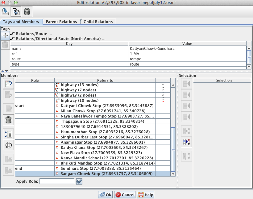
Apply the "role" "start" and "end" to the first and last stop, respectively. Example (screenshot of "Edit Relation" window):

(Note: All routes are treated as two-way unless oneway=yes is included in the relation itself.)
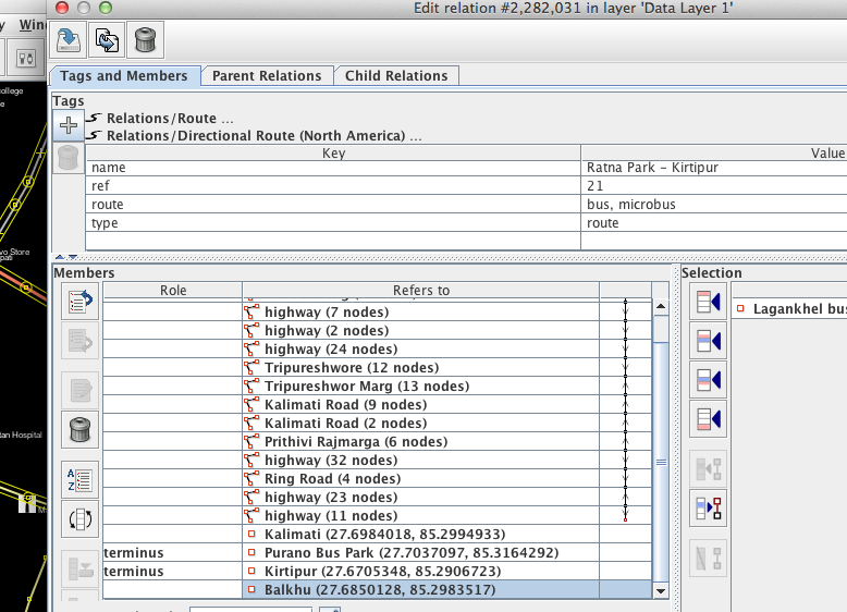
If you want to use the term "terminus" instead of "start" and "end", which reads better for two-way routes, you may do so as such:
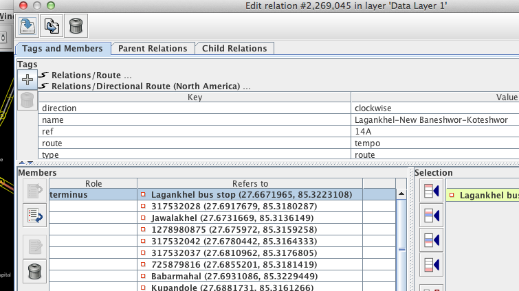
And finally, for looped routes, you can simply use a single "terminus" stop for the route:

