Template:Zh-hant:Map Features:cycleway
(Redirected from Zh-hant:Template:Map Features:cycleway)
Jump to navigation
Jump to search
自行車道 (cycleway)
描述針對單車設計的基礎設施。另見: Cycle routes.
| 關鍵字(key) | 值 (value) | 幾何 (element) | 描述 (desc) | 地圖標註 (render) | 照片 (photo) |
|---|---|---|---|---|---|
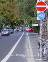
| cycleway | lane | 在道路之中的自行車道。 | Cyclist map
|

| |
| cycleway:right cycleway:left |
lane | A cycle lane only on one side of the road. Left or right depend on the direction in which the way is drawn in OpenStreetMap. | Cyclist map
|
||
| cycleway | opposite | 與oneway=yes一起使用,予許自行車道雙向通行。
注意:這樣的街道在比利時,荷蘭,丹麥常見,而在英國不常見(但它們存在)。相對地,在一般的情況下整條街道為雙向是正常的,除了在街道最尾端的很小一段設為禁止禁入,這個地方設有一小段的分隔島來使自行車不要進入,這被稱為自行車接口(cycle plug)。在許多地方則是以非常短的單線道與相鄰的自行車道相併,且有道路併入而形成三角形,或有許有一張短的單線道且具有 cycleway=opposite_lane 或 cycleway=opposite_track。 |
Cyclist map
|

| |
| cycleway | opposite_lane | 與oneway=yes一起使用,在道路之中的自行車道可予許相對於一般交通流動的反向通行。 | Cyclist map
|

| |
| cycleway | track | 與道路分隔的自行車道,如果需要可加入oneway=yes。 | Cyclist map
|

| |
| cycleway:right cycleway:left |
track | A track only on one side of the road. You can drive in both directions. Left and right depend on the direction in which the way is drawn in OpenStreetMap. | Cyclist map
|
||
| cycleway | opposite_track | 與 oneway=yes一起使用,與道路分隔的自行車道可予許相對於一般交通流動的反向通行。 | Cyclist map
|

| |
| cycleway | shared | Cyclists share space with other traffic on this highway. | |||
| cycleway | share_busway | There is a bus lane that cyclists are permitted to use. | 
| ||
| cycleway:right cycleway:left |
share_busway | A bus lane permitted to use only on one side of the road. Left and right depend on the direction in which the way is drawn in OpenStreetMap. | |||
| cycleway | shared_lane | Cyclists share a lane with motor vehicles, but there are markings indicating that they should share the lane with motorists. The road markings are usually there to highlight a cycle route or to remind drivers that you can cycle there. Also used for the on-road shared-lane marking called a "sharrow"[1]. | 
| ||
| cycleway:right cycleway:left |
shared_lane | A shared lane only on one side of the road. Left and right depend on the direction in which the way is drawn in OpenStreetMap. | |||
| cycleway | asl | A cycleway advanced stop line (ASL), also known as a bike box or an advanced stop box, is a marked area for cyclists in front of the stop line for motor traffic. | CyclOSM
|

| |
| cycleway | 使用者自訂 | 到Taginfo查詢常用標籤值 |
This table is a wiki template with a default description in English. Editable here.
此表格由模版自動生成,協助改善中譯版本請按此。