File:LA2-pixelcoast.png
Jump to navigation
Jump to search

No higher resolution available.
LA2-pixelcoast.png (671 × 595 pixels, file size: 59 KB, MIME type: image/png)
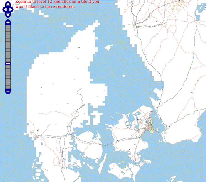
Screenshot of the map of Denmark at zoom=6 showing the Osmarender layer, generated by tiles@home. This picture shows the state of importing and fixing up coastlines. Denmark's islands Funen (Fyn) and Sealand (Sjælland) and Sweden's Scania (Skåne) have fine coastlines, but Jutland (Jylland) and Sweden's westcoast are still just very coarse pixels.
![]()
Contains map data © OpenStreetMap contributors, made available under the terms of the Creative Commons Attribution-ShareAlike 2.0 (CC-BY-SA-2.0).
File history
Click on a date/time to view the file as it appeared at that time.
| Date/Time | Thumbnail | Dimensions | User | Comment | |
|---|---|---|---|---|---|
| current | 08:03, 9 May 2007 | 671 × 595 (59 KB) | LA2 (talk | contribs) | Screenshot of the map of Denmark at zoom=6 showing the Osmarender layer, generated by tiles@home. This picture shows the state of importing and fixing up coastlines. Denmark's islands Funen (Fyn) and Sealand (Sjælland) an |
You cannot overwrite this file.
File usage
The following page uses this file: