Featured images/Jan-Mar 2015
< Featured images(Redirected from Featured Images/Jan-Mar 2015)
Jump to navigation
Jump to search

These are featured images, which have been identified as the best examples of OpenStreetMap mapping, or as useful illustrations of the OpenStreetMap project.
If you know another image of similar quality, you can nominate it on Featured image proposals.
| ← from January to March 2014 | ← from October to December 2014 | from April to June 2015 → | from January to March 2016 → |
Gallery of featured images, from January to March 2015

2015, week 1
2015, week 2
2015, week 3
2015, week 4
2015, week 5
2015, week 6
2015, week 7

2015, week 8
2015, week 9

2015, week 10
2015, week 11

2015, week 12

2015, week 13
Details and captions
Week 1 (from Monday 29 December 2014 to Sunday 4 January 2015) [Edit]

- English : WikiMedia Italia produced a 7 minute long OpenStreetMap video guide, which was recently presented by Simone Cortesi at the wikimedia Italia conference
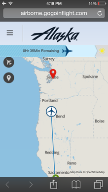
Week 2 (from Monday 5 January 2015 to Sunday 11 January 2015) [Edit]

- English : On Alaska Airlines, passengers can visualize the progress of their flight on their devices via Gogo WiFi inflight internet service
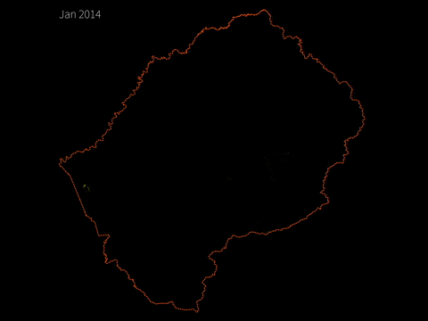
Week 3 (from Monday 12 January 2015 to Sunday 18 January 2015) [Edit]

- English : Animation showing the 2014 activity taking Lesotho from a blank spot on the map (approx 50k nodes) towards a full and rich set of map data. This work was completed in a large part by locals and government planners looking to utilise OpenStreetMap data as part of their workflow
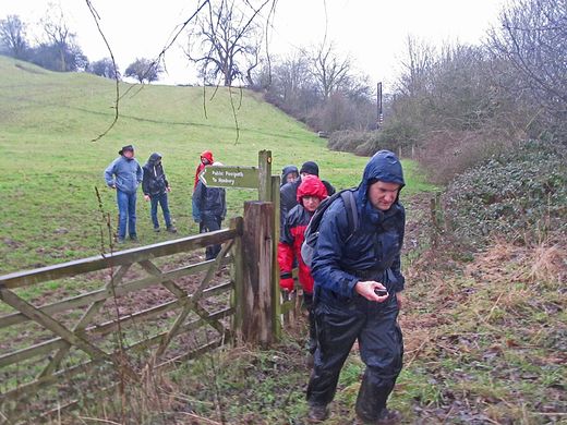
Week 4 (from Monday 19 January 2015 to Sunday 25 January 2015) [Edit]

- English : Come rain or shine: Mappers in Staffordshire, UK, having a new years mapping meet-up, heading out in search of missing footpaths. Read more on this blog post
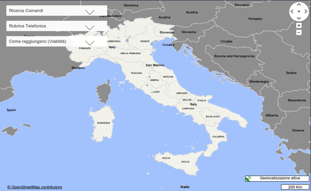
Week 5 (from Monday 26 January 2015 to Sunday 1 February 2015) [Edit]

- English : The website of the Italian gendarmerie (Carabinieri) now features as the only map, an OpenStreetMap map with a prominent copyright link. This is the first recorded use of a military force using OSM.
Week 6 (from Monday 2 February 2015 to Sunday 8 February 2015) [Edit]

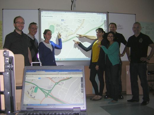
- English : German and Ecuadorian teachers of Geography, History and IT proudly present the results of a mapping training session with JOSM. These teachers will pass on this training to other colleagues, and integrate some aspects of it into the curriculum to help Ecuadorean students improve their skills further.
Week 7 (from Monday 9 February 2015 to Sunday 15 February 2015) [Edit]

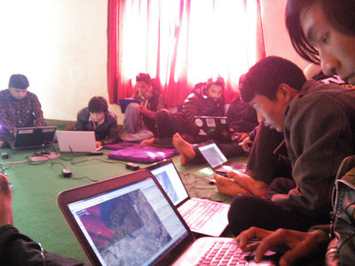
- English : Local citizens from Bajrabarahi, Makwanpur, Nepal mapping their towns and villages. Kathmandu Living Labs, pioneer of OpenStreetMap in Nepal, was involved in training them. The training mostly focused on mapping agriculture and food security data
Week 8 (from Monday 16 February 2015 to Sunday 22 February 2015) [Edit]

- English : Christian Quest experimented with creating a map as an Anaglyph 3D image. Available as a slippy map and a CartoCSS stylesheet. Now all we need is a pair of those special glasses!
Week 9 (from Monday 23 February 2015 to Sunday 1 March 2015) [Edit]

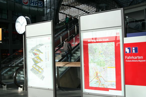
- English : The main station in Berlin now has detailed OpenStreetMap maps of the city.
Week 10 (from Monday 2 March 2015 to Sunday 8 March 2015) [Edit]

- English : OpenStreetMap Lesotho members on Lesotho National TV show talking about #MapLesotho
Week 11 (from Monday 9 March 2015 to Sunday 15 March 2015) [Edit]

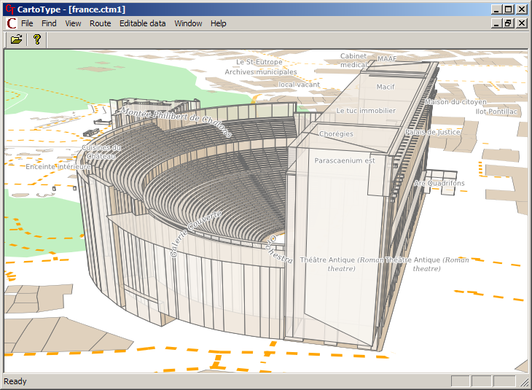
- English : Spectacular 3D-rendering of the Roman Theatre in Orange in France (map) made only from OpenStreetMap data mapped by Marcel Herault
Week 12 (from Monday 16 March 2015 to Sunday 22 March 2015) [Edit]

- English : Mappers in action with ICMS and Kathmandu Living Labs in Nepal
Week 13 (from Monday 23 March 2015 to Sunday 29 March 2015) [Edit]

- English : The "tronish" style showing Chigaco. View the animated dynamic 3D map here. One of several striking maps created by Mapzen using their "Tangram" system