File:2008-09-07 BavarianRailNetwork.jpg
Jump to navigation
Jump to search

Size of this preview: 583 × 600 pixels. Other resolutions: 233 × 240 pixels | 467 × 480 pixels | 747 × 768 pixels | 995 × 1,024 pixels | 1,991 × 2,048 pixels | 4,870 × 5,010 pixels.
Original file (4,870 × 5,010 pixels, file size: 982 KB, MIME type: image/jpeg)
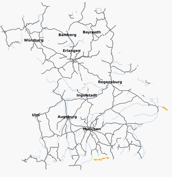
Bavarian Railway Network, based on OSM data of September 7, 2008. There are still quite some flaws in this map. For example, bridges and tunnels are displayed as gaps. For the moment, it's better than nothing (or, to be more precise, outdated maps).
Rendered with osmarender and default settings on zoom level 7, except for the scale (here: 0.1) and disabled OSM layers.
![]()
Contains map data © OpenStreetMap contributors, made available under the terms of the Creative Commons Attribution-ShareAlike 2.0 (CC-BY-SA-2.0).
File history
Click on a date/time to view the file as it appeared at that time.
| Date/Time | Thumbnail | Dimensions | User | Comment | |
|---|---|---|---|---|---|
| current | 19:21, 8 September 2008 | | 4,870 × 5,010 (982 KB) | Bigbug21 (talk | contribs) | Bavarian Railway Network, based on OSM data of September 7, 2008. There are still quite some flaws in this map. For example, bridges and tunnels are displayed as gaps. For the moment, it's better than nothing (or, to be more precise, outdated maps). Rend |
You cannot overwrite this file.
File usage
The following page uses this file: