File:2013 GutauWanderkarteHinten.jpg
Jump to navigation
Jump to search

Size of this preview: 450 × 600 pixels. Other resolutions: 180 × 240 pixels | 360 × 480 pixels | 576 × 768 pixels | 768 × 1,024 pixels | 2,448 × 3,264 pixels.
Original file (2,448 × 3,264 pixels, file size: 3.38 MB, MIME type: image/jpeg)

Summary
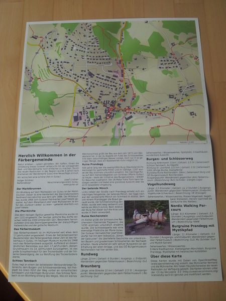
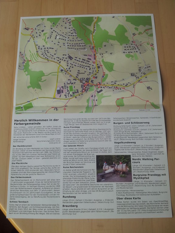
[English] Hiking/Biking map of Gutau, Austria, back side, published 2013, made by User:Numenor
[Deutsch] Rad- und Wanderkarte Gutau, Österreich, Rückseite, herausgegeben 2013, von User:Numenor
→ https://lorien.ancalime.de/gutau.html
Licensing
![]()
![]()
![]()
This work is licensed under the Creative Commons Attribution-ShareAlike 2.0 License.
Attribution not specified as a parameter! THIS LICENSE ALWAYS REQUIRES ATTRIBUTION! Use {{CC-BY-SA-2.0|Attribution, typically name of author}} See Template:CC-BY-SA-2.0 for full description how this template should be used.
Note, there is
There is also
Attribution not specified as a parameter! THIS LICENSE ALWAYS REQUIRES ATTRIBUTION! Use {{CC-BY-SA-2.0|Attribution, typically name of author}} See Template:CC-BY-SA-2.0 for full description how this template should be used.
Note, there is
{{CC-BY-SA-2.0 OpenStreetMap}} for files based on old OSM map data, before the license change made on 2012-09-12.There is also
{{OSM Carto screenshot||old_license}} for files based on old OSM map data, before the license change made on 2012-09-12, created using OSM Carto map style.
File history
Click on a date/time to view the file as it appeared at that time.
| Date/Time | Thumbnail | Dimensions | User | Comment | |
|---|---|---|---|---|---|
| current | 03:58, 3 October 2014 | | 2,448 × 3,264 (3.38 MB) | Al. (talk | contribs) | [English] Hiking/Biking map of Gutau, Austria, back side, published 2013, made by User:Numenor [Deutsch] Rad- und Wanderkarte Gutau, Österreich, Rückseite, herausgegeben 2013, von User:Numenor → https://lorien.ancalime.de/gutau... |
You cannot overwrite this file.
File usage
The following 3 pages use this file: