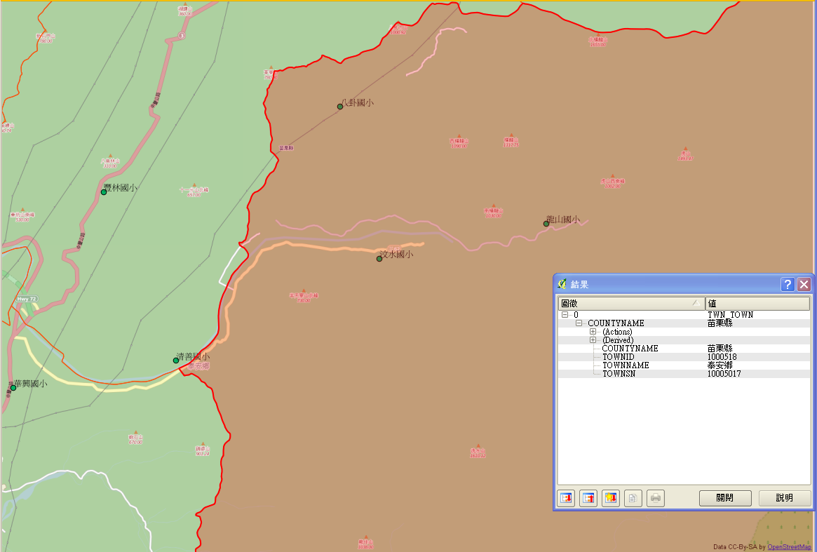
File:20140201 000 泰安鄉1.png
Jump to navigation
Jump to search

Size of this preview: 800 × 540 pixels. Other resolutions: 320 × 216 pixels | 640 × 432 pixels | 1,024 × 692 pixels | 1,165 × 787 pixels.
Original file (1,165 × 787 pixels, file size: 162 KB, MIME type: image/png)
Summary
combine GEOnet_Names_Server POI of school with OpenStreetMap overlay by QGIS Check for school in Taian, Maoli with the help of Bing satelite image
Licensing
| Contains map data © OpenStreetMap contributors, made available under the terms of the Open Database License (ODbL).
The ODbL does not require any particular license for maps produced from ODbL data, produced maps may be subject also to other licences. |
File history
Click on a date/time to view the file as it appeared at that time.
| Date/Time | Thumbnail | Dimensions | User | Comment | |
|---|---|---|---|---|---|
| current | 03:25, 1 February 2014 | | 1,165 × 787 (162 KB) | Supaplex (talk | contribs) | combine GEOnet_Names_Server POI of school with OpenStreetMap overlay by QGIS Check for school in Taian, Maoli with the help of Bing satelite image |
You cannot overwrite this file.
File usage
The following page uses this file: