File:Aarhus subdivision.png
Jump to navigation
Jump to search
Size of this preview: 465 × 600 pixels. Other resolutions: 186 × 240 pixels | 372 × 480 pixels | 595 × 768 pixels | 1,090 × 1,406 pixels.
Original file (1,090 × 1,406 pixels, file size: 715 KB, MIME type: image/png)
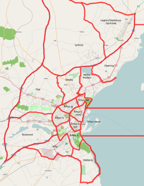
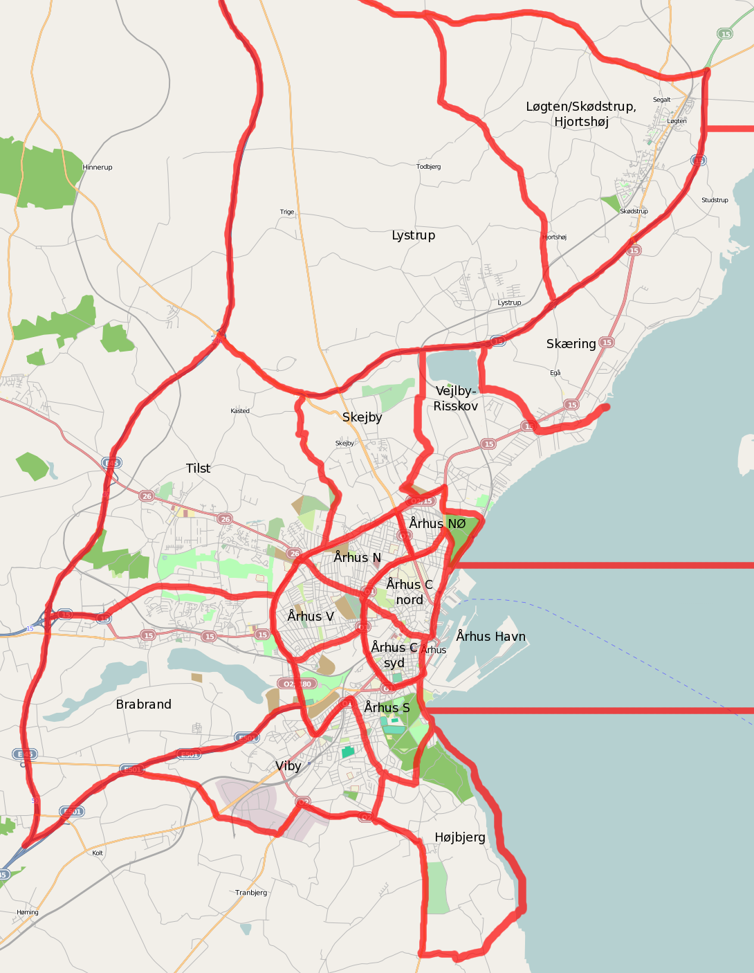
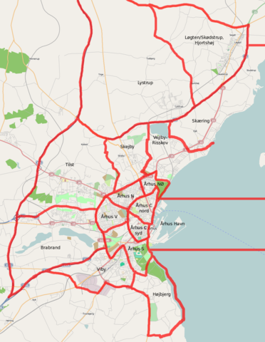
Sketch of the subdivision of Århus by E klausen.
Licensing
![]()
![]()
![]()
This screenshot contains OpenStreetMap Carto rendering.
The OpenStreetMap Carto map style is made available under the Creative Commons CC-0 1.0 Universal Public Domain Dedication.
- Attribution to the map data:
![]()
Contains map data © OpenStreetMap contributors, made available under the terms of the Creative Commons Attribution-ShareAlike 2.0 (CC-BY-SA-2.0).
File history
Click on a date/time to view the file as it appeared at that time.
| Date/Time | Thumbnail | Dimensions | User | Comment | |
|---|---|---|---|---|---|
| current | 13:08, 5 June 2009 | | 1,090 × 1,406 (715 KB) | Freek (talk | contribs) | Added remaining borders. |
| 17:59, 4 June 2009 | 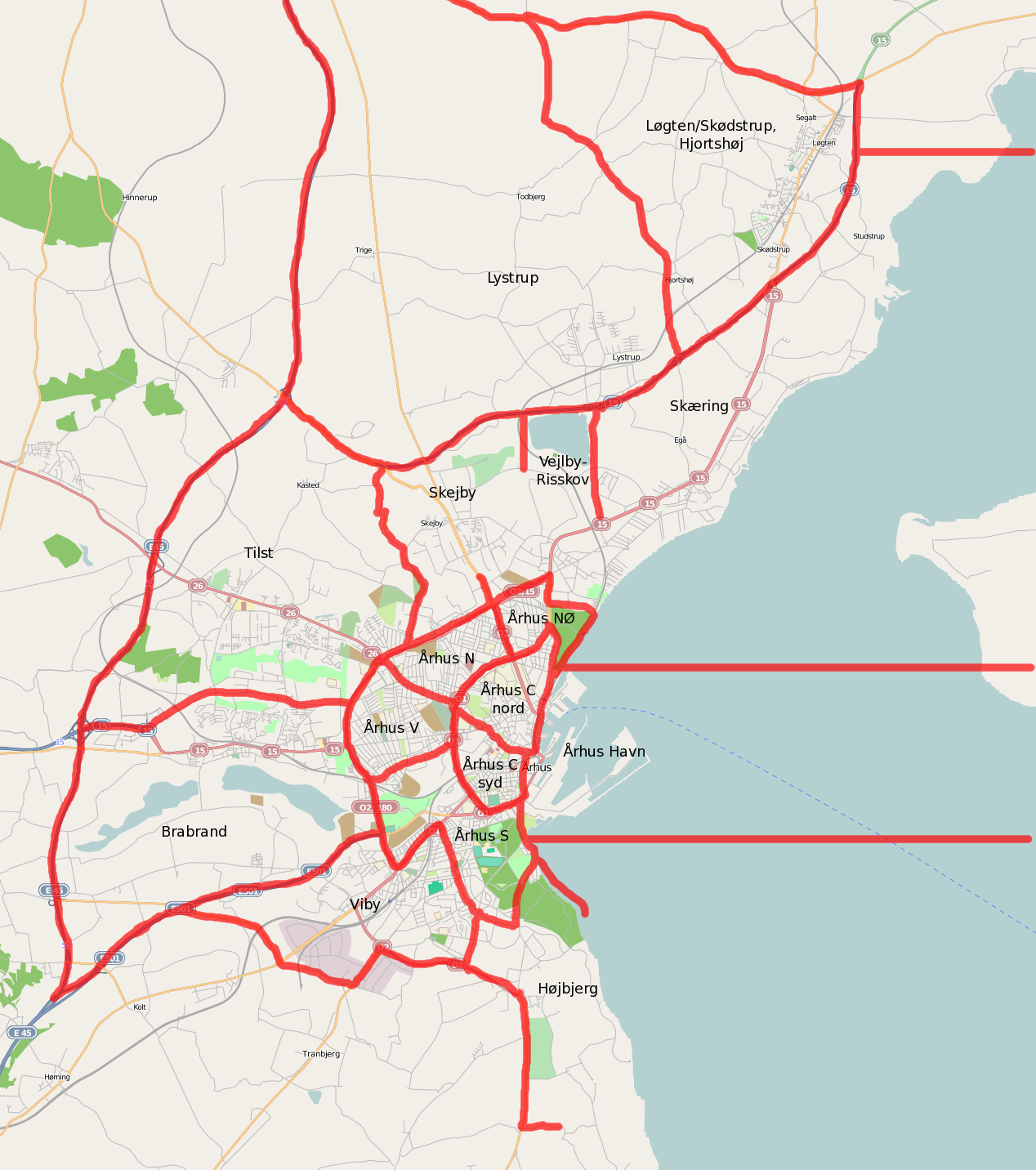 | 1,268 × 1,432 (745 KB) | Freek (talk | contribs) | Sketch of the subdivision of Århus by E klausen. |
You cannot overwrite this file.
File usage
The following page uses this file: