File:Aeroway holding position digitization direction.jpg
Original file (834 × 641 pixels, file size: 124 KB, MIME type: image/jpeg)
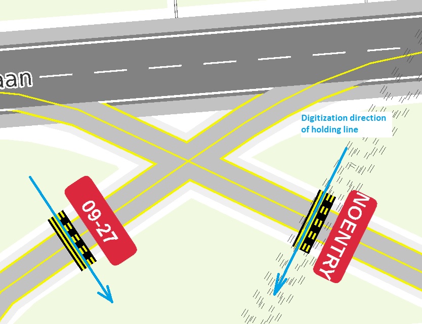
Aeroway holding position incorrect orientation due to the digitization direction of the holding position. The "NOENTRY" sign is upside down compared to the runway it needs to protect. Changing the digitization direction of the holding position and using a common standard for this in OpenStreetMap, would solve these issues.
Image based on PDF output from a GIS based OpenStreetMap renderer and style created by myself.
- This media file was uploaded by author of the work and its copyright holder.
![]()
![]()
The person who associated a work with this deed has dedicated the work to the public domain by waiving all of his or her rights to the work worldwide under copyright law, including all related and neighboring rights, to the extent allowed by law. You can copy, modify, distribute and perform the work, even for commercial purposes, all without asking permission.
File history
Click on a date/time to view the file as it appeared at that time.
| Date/Time | Thumbnail | Dimensions | User | Comment | |
|---|---|---|---|---|---|
| current | 19:19, 27 March 2021 | | 834 × 641 (124 KB) | Mboeringa (talk | contribs) |
You cannot overwrite this file.
File usage
The following page uses this file: