File:Babeloued.png
Jump to navigation
Jump to search


Size of this preview: 769 × 599 pixels. Other resolutions: 308 × 240 pixels | 616 × 480 pixels | 866 × 675 pixels.
Original file (866 × 675 pixels, file size: 174 KB, MIME type: image/png)
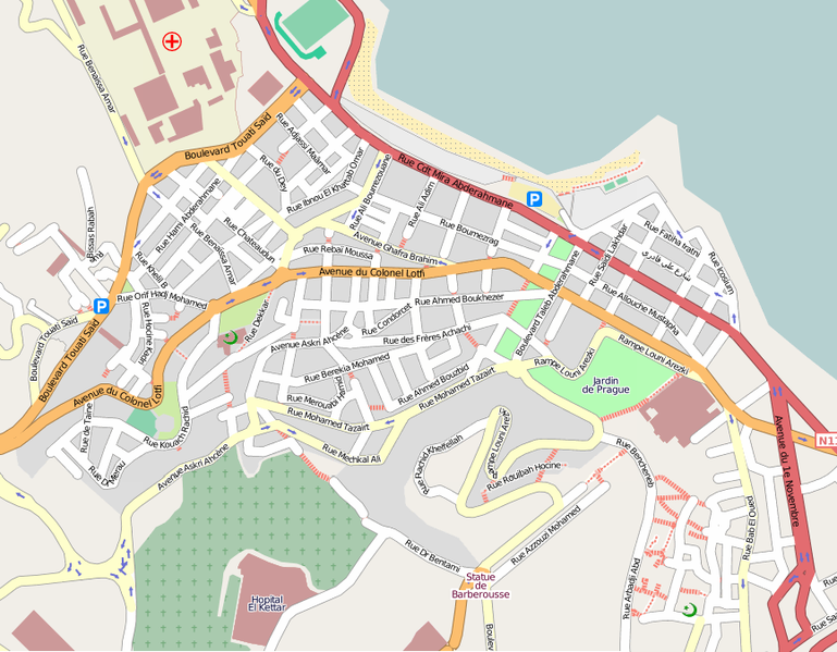
Mapping of the are of Bab El Oued in Algiers.
This is a Featured image, which means that it has been identified as one of the best examples of OpenStreetMap mapping, or that it provides a useful illustration of the OpenStreetMap project. If you know another image of similar quality, you can nominate it on Featured image proposals.
Front-page image on 04 Oct 2008
File history
Click on a date/time to view the file as it appeared at that time.
| Date/Time | Thumbnail | Dimensions | User | Comment | |
|---|---|---|---|---|---|
| current | 15:52, 30 September 2008 | | 866 × 675 (174 KB) | Sandervalya (talk | contribs) | Mapping of the are of Bab El Oued in Algiers. |
You cannot overwrite this file.
File usage
The following 2 pages use this file: