File:Bangalore India traffic.jpg

Original file (3,456 × 2,304 pixels, file size: 2.1 MB, MIME type: image/jpeg)
Summary
| Description |
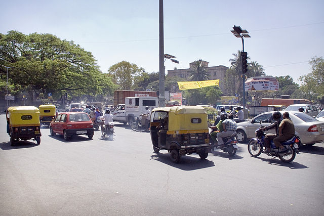
Another glimpse of the utter and complete chaos that is traffic in Bangalore, India. What's missing in this photograph is the insane change of lanes happening all the time (due to the fact that there really aren't any lanes - in itself a not so comforting thought), motorcycles forcing themselves in wherever they can fit, people on bikes, auto rickshaws, cars, buses, taxis operated by crazy people, wagons pulled by horses, pedestrians crossing wherever they dare to, entire families riding on bicycles (two parents and two kids seems rather common), people driving in the opposite lane if it's free, people driving on the sidewalk if they have to and of course the constant banging on the horn. Insanity defined. |
| Date | |
| Source | Insanity Defined |
| Author | Eirik Refsdal from Trondheim, NORWAY |
| Camera location | | View this and other nearby images on: OpenStreetMap |
|---|
Licensing
- You are free:
- to share – to copy, distribute and transmit the work
- to remix – to adapt the work
- Under the following conditions:
- attribution – You must give appropriate credit, provide a link to the license, and indicate if changes were made. You may do so in any reasonable manner, but not in any way that suggests the licensor endorses you or your use.
| This image was originally posted to Flickr by eirikref at https://www.flickr.com/photos/34034335@N00/2302892094. It was reviewed on 26 May 2009 by FlickreviewR and was confirmed to be licensed under the terms of the cc-by-2.0. |
File history
Click on a date/time to view the file as it appeared at that time.
| Date/Time | Thumbnail | Dimensions | User | Comment | |
|---|---|---|---|---|---|
| current | 00:16, 26 May 2009 | | 3,456 × 2,304 (2.1 MB) | wikimediacommons>FlickreviewR | Replacing image by its original image from Flickr |
File usage
The following page uses this file: