File:Barrier and waypoint-ES.svg
Jump to navigation
Jump to search


Size of this PNG preview of this SVG file: 270 × 270 pixels. Other resolutions: 240 × 240 pixels | 480 × 480 pixels | 768 × 768 pixels | 1,024 × 1,024 pixels.
Original file (SVG file, nominally 270 × 270 pixels, file size: 23 KB)
Summary
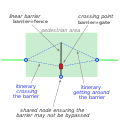
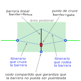
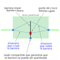
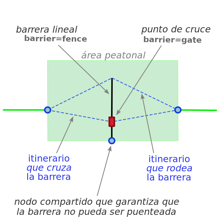
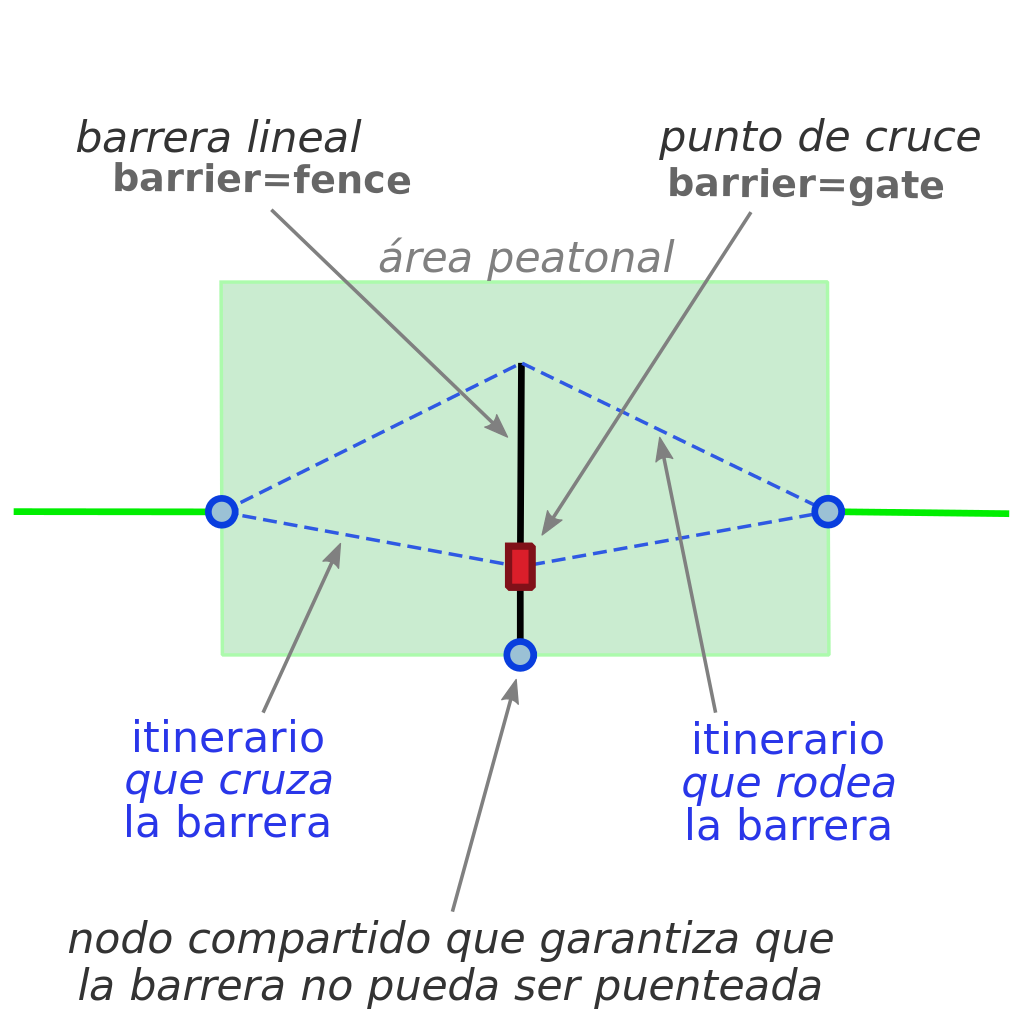
Pedestrian area routing – a linear barrier that can be got around or crossed through a waypoint.
Other versions
Version in English

Licensing
![]()
![]()
![]()
This work is licensed under the Creative Commons Attribution-ShareAlike 4.0 License.
Attribution: Carto'Cité
Attribution: Carto'Cité
File history
Click on a date/time to view the file as it appeared at that time.
| Date/Time | Thumbnail | Dimensions | User | Comment | |
|---|---|---|---|---|---|
| current | 10:12, 7 September 2019 | | 270 × 270 (23 KB) | Dcapillae (talk | contribs) | Pedestrian area routing – a linear barrier that can be got around or crossed through a waypoint. == Other versions == <gallery> File:Barrier and waypoint-EN.svg|Version in English </gallery> |
You cannot overwrite this file.
File usage
The following 2 pages use this file: