File:Basemap.at Potlatch2.png
Jump to navigation
Jump to search

Size of this preview: 800 × 600 pixels. Other resolutions: 320 × 240 pixels | 640 × 480 pixels | 876 × 657 pixels.
Original file (876 × 657 pixels, file size: 354 KB, MIME type: image/png)
Summary
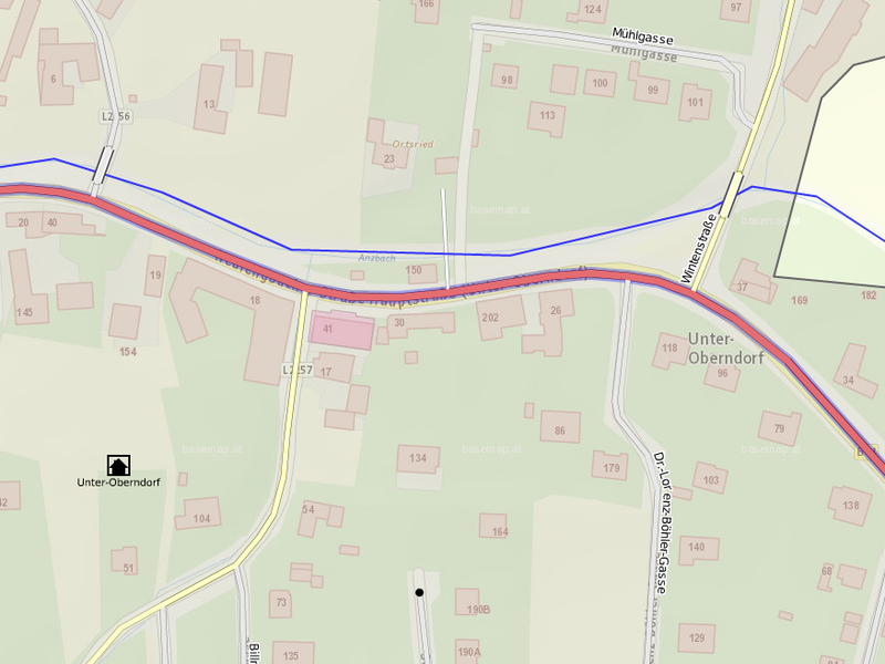
basemap.at (based on cadastre data) as background map in Potlatch 2 (and – apparently – OSM data on top)
Location: Village Unter-Oberndorf
Licensing
- basemap:

 This work is licensed under the Creative Commons Attribution 3.0 License.
Attribution not specified as a parameter! THIS LICENSE ALWAYS REQUIRES ATTRIBUTION! Use {{CC-BY-3.0|Attribution, typically name of author}} See Template:CC-BY-3.0 for full description how this template should be used.
In fact it is licensed under the AT version of this license.
- overlayed data (apparently): © OpenStreetMap contributors, ODbL.
File history
Click on a date/time to view the file as it appeared at that time.
| Date/Time | Thumbnail | Dimensions | User | Comment | |
|---|---|---|---|---|---|
| current | 12:56, 7 December 2013 | | 876 × 657 (354 KB) | Al. (talk | contribs) | basemap.at - Basemap of Austria based on cadastre data published CC-BY 3.0 AT, use for OpenStreetMap permitted |
You cannot overwrite this file.
File usage
The following page uses this file: