File:Bedford new slippy map 2.png
Jump to navigation
Jump to search


No higher resolution available.
Bedford_new_slippy_map_2.png (636 × 498 pixels, file size: 327 KB, MIME type: image/png)
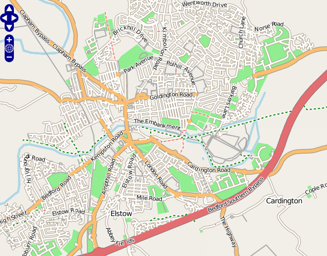
Map of Bedford
This map and others like it, were created by OpenStreetmap contributors, and are licensed as Creative Commons CC-BY-SA 2.0 (https://creativecommons.org/licenses/by-sa/2.0/) (see OpenStreetMap licence).
Use {{mapof|PlaceName}} to add this template to your images.
This map and others like it, were created by OpenStreetmap contributors, and are licensed as Creative Commons CC-BY-SA 2.0 (https://creativecommons.org/licenses/by-sa/2.0/) (see OpenStreetMap licence).
Use {{mapof|PlaceName}} to add this template to your images.
This image also shows zooming and panning controls of an old version of OpenLayers
This is a Featured image, which means that it has been identified as one of the best examples of OpenStreetMap mapping, or that it provides a useful illustration of the OpenStreetMap project. If you know another image of similar quality, you can nominate it on Featured image proposals.
Front-page image on 02 Dec 2006
File history
Click on a date/time to view the file as it appeared at that time.
| Date/Time | Thumbnail | Dimensions | User | Comment | |
|---|---|---|---|---|---|
| current | 20:15, 10 November 2006 | | 636 × 498 (327 KB) | Ojw (talk | contribs) | {{mapof|Bedford}} |
You cannot overwrite this file.
File usage
The following 17 pages use this file:
- Az:Xəritəyə baxış
- Da:Browsing
- Development activity (2004-2010)
- Eo:Using OpenStreetMap
- Featured image proposals/Archive 2006
- He:Using OpenStreetMap
- List of featured images/2006
- Pt:Browsing
- FR:Images remarquables/Avant 2009
- FR:Slippy Map
- FR:Utilisation d'OpenStreetMap
- ES:Mapa deslizante
- IT:Slippy Map
- RU:Использование данных OSM
- RU:Подвижная карта
- RU:Просмотр карты
- JA:スリッピーマップ