File:Bing-OWL.png
Jump to navigation
Jump to search


Size of this preview: 473 × 599 pixels. Other resolutions: 189 × 240 pixels | 379 × 480 pixels | 606 × 768 pixels | 808 × 1,024 pixels | 1,523 × 1,930 pixels.
Original file (1,523 × 1,930 pixels, file size: 1.02 MB, MIME type: image/png)
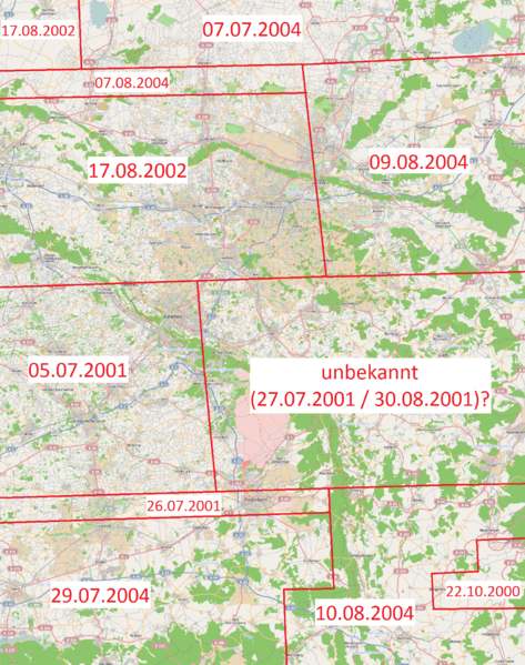
Aufnahmedatum der BING-Luftbilder für Ostwesfalen-Lippe. Die Grenzen sind nur grob und können um ein paar km abweichen. Sie sind in den Bildern durch farbliche Änderungen erkennbar. Quelle ist eine nicht mehr verfügbare Anwendung der Erstellfirma.
![]()
Contains map data © OpenStreetMap contributors, made available under the terms of the Creative Commons Attribution-ShareAlike 2.0 (CC-BY-SA-2.0).
File history
Click on a date/time to view the file as it appeared at that time.
| Date/Time | Thumbnail | Dimensions | User | Comment | |
|---|---|---|---|---|---|
| current | 08:44, 15 December 2010 | | 1,523 × 1,930 (1.02 MB) | ABRob (talk | contribs) | Aufnahmedatum der BING-Luftbilder für Ostwesfalen-Lippe. Die Grenzen sind nur grob und können um ein paar km abweichen. Sie sind in den Bildern durch farbliche Änderungen erkennbar. Quelle ist eine nicht mehr verfügbare Anwendung der Erstellfirma. |
You cannot overwrite this file.
File usage
There are no pages that use this file.