File:Bing imagery showing buildings and barrier.png
Jump to navigation
Jump to search


No higher resolution available.
Bing_imagery_showing_buildings_and_barrier.png (247 × 237 pixels, file size: 25 KB, MIME type: image/png)
Summary
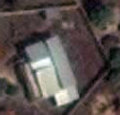
Original name "Screenshot_from_2014-04-09_19:41:56.png", captured using Take Screenshot utility on Ubuntu Linux OS. Captured from within JOSM while displaying Bing Imagery.
![]()
![]()
This image is composed entirely, or almost entirely, of Bing aerial imagery.
Bing imagery is not open licensed, but is generously made available to the OpenStreetMap project for deriving open licensed map data in editors such as JOSM, iD or Vespucci. This upload is not covered by permission described at Bing Maps, as OSM Wiki cannot be interpreted as "editor application" and "We require you use access credentials to use the service and require use of transaction tracking and/or session tracking methods for all uses of the service" is not fulfilled.
This image is a relatively minor extract of the (worldwide) Bing imagery, used for illustrative purposes on the OpenStreetMap wiki, to help document ways of using and interpreting the imagery in the OpenStreetMap mapping process.
This image is a relatively minor extract of the (worldwide) Bing imagery, used for illustrative purposes on the OpenStreetMap wiki, to help document ways of using and interpreting the imagery in the OpenStreetMap mapping process.
File history
Click on a date/time to view the file as it appeared at that time.
| Date/Time | Thumbnail | Dimensions | User | Comment | |
|---|---|---|---|---|---|
| current | 09:42, 20 July 2019 | | 247 × 237 (25 KB) | The RedBurn (talk | contribs) | Color balance |
| 23:45, 9 April 2014 | 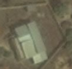 | 247 × 237 (19 KB) | Ceyockey (talk | contribs) | Original name "Screenshot_from_2014-04-09_19:41:56.png", captured using Take Screenshot utility on Ubuntu Linux OS. Captured from within JOSM while displaying Bing Imagery. |
You cannot overwrite this file.
File usage
The following 48 pages use this file:
- Ar:Map Features
- Az:Map Features
- Cs:Key:barrier
- Cs:Map Features
- Da:Map Features
- El:Map Features
- Hu:Key:barrier
- Hu:Map Features
- Key:barrier
- Pt:Key:barrier
- Pt:Map Features
- Ro:Map Features
- Tag:barrier=yes
- Uk:Key:barrier
- Uk:Об'єкти мапи
- Zh-hant:Map Features
- User:Gmbo/Motorrad
- Wiki:Files used by data items/2
- Template:Ar:Map Features:barrier
- Template:Az:Map Features:barrier
- Template:Cs:Map Features:barrier
- Template:DE:Map Features:barrier
- Template:Da:Map Features:barrier
- Template:El:Map Features:barrier
- Template:Et:Map Features:barrier
- Template:Generic:ES:Map Features:barrier
- Template:Generic:Map Features:barrier
- Template:Hu:Map Features:barrier
- Template:JA:Map Features:barrier
- Template:NL:Map Features:barrier
- Template:Pl:Generic:Map Features:barrier
- Template:Pt:Map Features:barrier
- Template:RU:Generic:Map Features:barrier
- Template:Ro:Map Features:barrier
- Template:Sv:Map Features:barrier
- Template:Uk:Map Features:barrier
- Template:Zh-hant:Map Features:barrier
- DE:Key:barrier
- DE:Map Features
- ES:Tag:barrier=yes
- IT:Tag:barrier=yes
- NL:Kaartelementen
- NL:Key:barrier
- RU:Key:barrier
- RU:Tag:barrier=yes
- RU:Объекты карты
- JA:Key:barrier
- JA:Map Features