File:Boundary.png
Jump to navigation
Jump to search

No higher resolution available.
Boundary.png (240 × 189 pixels, file size: 10 KB, MIME type: image/png)
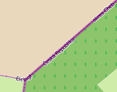
Map view showing a part of border Germany to Czech republic. Screenshot from OSM display of 2010-05-31.
File history
Click on a date/time to view the file as it appeared at that time.
| Date/Time | Thumbnail | Dimensions | User | Comment | |
|---|---|---|---|---|---|
| current | 15:28, 31 May 2010 | | 240 × 189 (10 KB) | Stoecker (talk | contribs) | Use another width for better display. |
| 15:22, 31 May 2010 |  | 190 × 180 (8 KB) | Stoecker (talk | contribs) | Map view showing a part of border Germany to Czech republic. Screenshot from OSM display of 2010-05-31. |
You cannot overwrite this file.
File usage
The following 19 pages use this file:
- Ca:Relation:boundary
- Cs:Relation:boundary
- Pl:Relacja
- Pl:Relation:boundary
- Relation:boundary
- Tag:type=boundary
- Types of relations
- Uk:Relation:boundary
- Uk:Tag:type=boundary
- User:Skybunny/Relation:boundary
- User:Skybunny/Relation:place
- Wiki:Files used by data items/1
- DE:Relation:boundary
- DE:Types of relation
- FR:Relation:boundary
- ES:Relation:boundary
- ES:Tipos de relación
- RU:Relation:boundary
- JA:Relation:boundary