File:Br-classificacao-sao-joao-del-rei-mg-plano-diretor.png
Jump to navigation
Jump to search

Size of this preview: 579 × 599 pixels. Other resolutions: 232 × 240 pixels | 464 × 480 pixels | 1,022 × 1,058 pixels.
Original file (1,022 × 1,058 pixels, file size: 137 KB, MIME type: image/png)
Summary
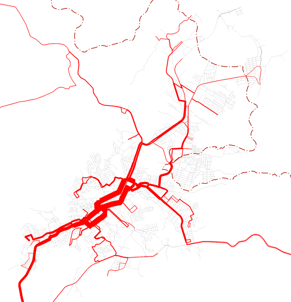
Superposição das linhas da rede de transporte coletivo na área urbana, indicando um aspecto da importância relativa das vias urbanas, publicada em 7 de abril de 2015.
Disponível oficialmente no site da Prefeitura, em Licitações > Processos licitatórios - 2013 a 2016 > Concorrência pública > Anexos > Anexo I - Projeto básico - Termo de referência > 3. Sistema de transporte coletivo.
Licensing
![]()
This file has been released into the public domain by the copyright holder, its copyright has expired, or it is ineligible for copyright. This applies worldwide.
Please, please use more specific template such as {{PD-self}} / {{PD-creator}} / {{PD-shape}} / {{PD-USGov}} / {{PD-old}} / {{PD-RU-exempt}} ... This template is not making clear why this work is in the public domain.
Please, please use more specific template such as {{PD-self}} / {{PD-creator}} / {{PD-shape}} / {{PD-USGov}} / {{PD-old}} / {{PD-RU-exempt}} ... This template is not making clear why this work is in the public domain.
File history
Click on a date/time to view the file as it appeared at that time.
| Date/Time | Thumbnail | Dimensions | User | Comment | |
|---|---|---|---|---|---|
| current | 12:56, 3 July 2020 | | 1,022 × 1,058 (137 KB) | Ftrebien (talk | contribs) | Superposição das linhas da rede de transporte coletivo na área urbana, indicando um aspecto da importância relativa das vias urbanas, publicada em 7 de abril de 2015. Disponível oficialmente no site da [http://www.saojoaodelrei.mg.gov.br/ Prefeitura], em [http://www.saojoaodelrei.mg.gov.br/pagina/7654/Licita%C3%A7%C3%B5es Licitações] > [http://www.saojoaodelrei.mg.gov.br/pagina/2178/Licita%C3%A7%C3%B5es Processos licitatórios - 2013 a 2016] > [http://saojoaodelrei.mg.gov.br/pagina/2231/Conco... |
You cannot overwrite this file.
File usage
The following page uses this file: