File:Building part areas in building area.svg
Jump to navigation
Jump to search


Size of this PNG preview of this SVG file: 219 × 196 pixels. Other resolutions: 268 × 240 pixels | 536 × 480 pixels | 858 × 768 pixels | 1,144 × 1,024 pixels.
Original file (SVG file, nominally 219 × 196 pixels, file size: 6 KB)
Summary
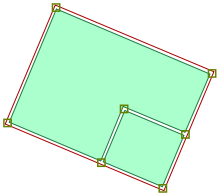
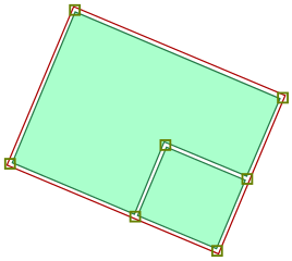
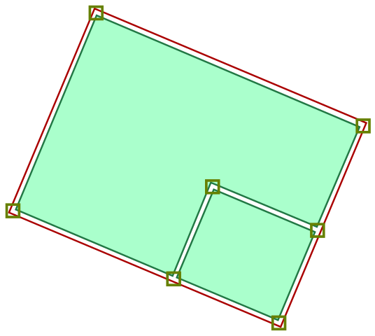
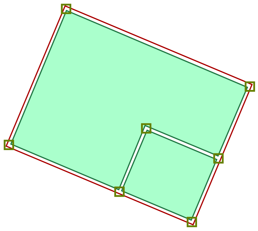
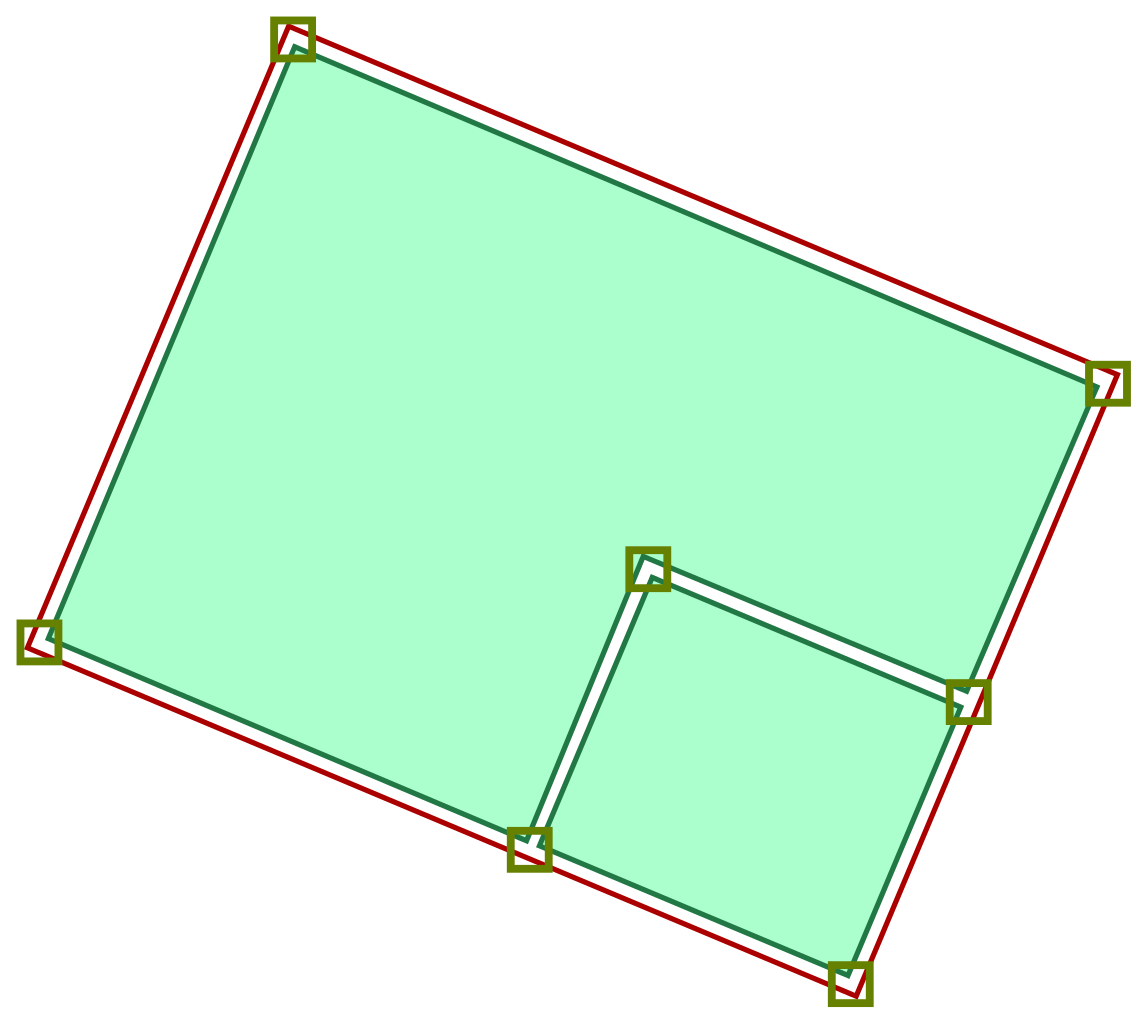
Two building:part areas within a building area, defined by closed way outlines. Squares represent nodes.
Licensing
![]()
This file has been released into the public domain by the copyright holder, its copyright has expired, or it is ineligible for copyright. This applies worldwide.
Please, please use more specific template such as {{PD-self}} / {{PD-creator}} / {{PD-shape}} / {{PD-USGov}} / {{PD-old}} / {{PD-RU-exempt}} ... This template is not making clear why this work is in the public domain.
Please, please use more specific template such as {{PD-self}} / {{PD-creator}} / {{PD-shape}} / {{PD-USGov}} / {{PD-old}} / {{PD-RU-exempt}} ... This template is not making clear why this work is in the public domain.
File history
Click on a date/time to view the file as it appeared at that time.
| Date/Time | Thumbnail | Dimensions | User | Comment | |
|---|---|---|---|---|---|
| current | 16:35, 31 July 2012 | | 219 × 196 (6 KB) | Tordanik (talk | contribs) | Two building:part areas within a building area, defined by closed way outlines. Squares represent nodes. |
You cannot overwrite this file.
File usage
The following 24 pages use this file:
- Cs:Jednoduché 3D budovy
- Ko:Relation:building
- Ko:간단한 3D 건물
- Pl:Relacja
- Pl:Relation:building
- Pl:Schemat tagowania budynków 3D
- Pt:Construções 3D simples
- Relation:building
- Simple 3D Buildings
- Types of relations
- Uk:Relation:building
- Zh-hans:基本三维建筑
- Zh-hant:Simple 3D Buildings
- Wiki:Files used by data items/1
- DE:Simple 3D Buildings
- DE:Types of relation
- FR:Bâtiments 3D simples
- ES:Edificios 3D sencillos
- ES:Relation:building
- ES:Tipos de relación
- RU:Отношения:здание
- RU:Простые 3D здания
- JA:Relation:building
- JA:基本的な3Dの建物