File:Busway2.jpg
Jump to navigation
Jump to search

Size of this preview: 800 × 340 pixels. Other resolutions: 320 × 136 pixels | 640 × 272 pixels | 1,790 × 761 pixels.
Original file (1,790 × 761 pixels, file size: 414 KB, MIME type: image/jpeg)
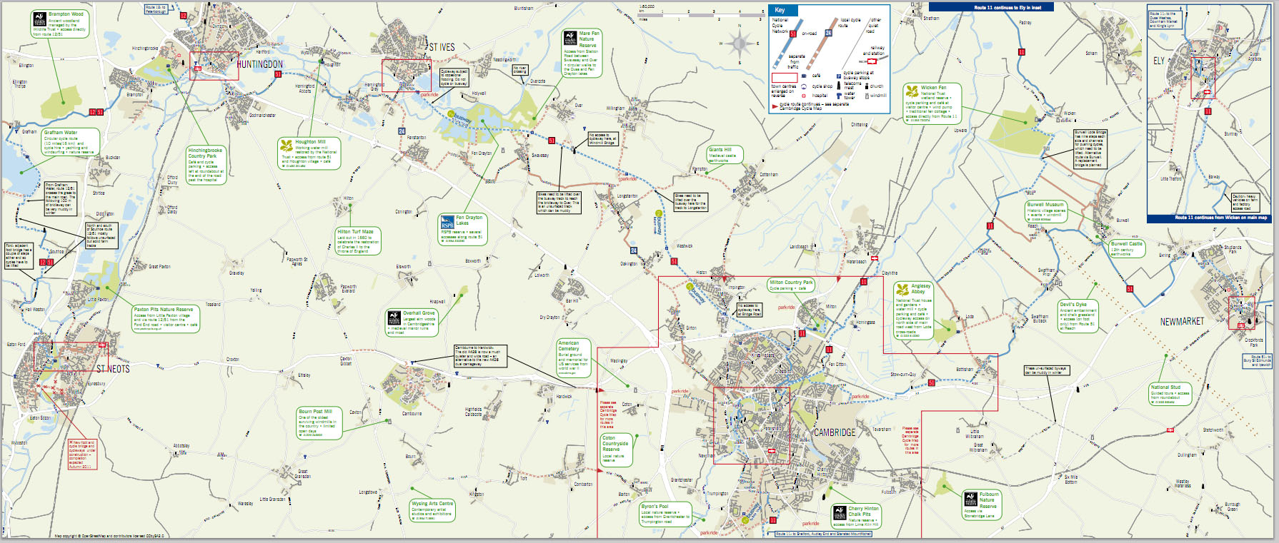
Another map featuring the Cambridgeshire Guided Busway. See also File:Busway1.jpg (featured image)
Cambridgeshire County Council commissioned a map for cyclists based around the busway route, which will become National Cycle Route 51 once some repairs are completed near St Ives. This was done entirely from OpenStreetMap data and published on paper earlier in 2011 and is available on Cambridgeshire County Council's web site.
OSM excerpt from [1]
File history
Click on a date/time to view the file as it appeared at that time.
| Date/Time | Thumbnail | Dimensions | User | Comment | |
|---|---|---|---|---|---|
| current | 10:41, 10 August 2011 | | 1,790 × 761 (414 KB) | David.earl (talk | contribs) |
You cannot overwrite this file.
File usage
There are no pages that use this file.