File:Cartopartiemlg.jpg.jpg
Jump to navigation
Jump to search


No higher resolution available.
Cartopartiemlg.jpg.jpg (710 × 533 pixels, file size: 145 KB, MIME type: image/jpeg)
This is a Featured image, which means that it has been identified as one of the best examples of OpenStreetMap mapping, or that it provides a useful illustration of the OpenStreetMap project. If you know another image of similar quality, you can nominate it on Featured image proposals.
Front-page image for week 50 of 2010 (13–19 Dec.).
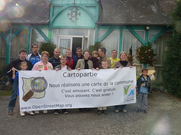
- Image descriptions
- English : A great day mapping for residents of Montreuil-le-Gast ([1]) (Brittany, France). The first time for many of us, but ultimately a great success! To be continued...
- français : Une grosse journée de cartographie pour les habitants de Montreuil-le-Gast ([2]) (Bretagne-France). Une première pour beaucoup d'entre nous mais une grande réussite au final ! A suivre...
- italiano : Una grande giornata di mappatura per i residenti di Montreuil-le-Gast ([3]) (Bretagna, Francia). La prima volta per alcuni di noi, ma alla fine un grande successo! Alla prossima volta...
- polski : Dzień pełen kartografii dla mieszkańców Montreuil-le-Gast w Bretanii. Dla wielu z nas pierwszy, ale zakończony sukcesem. Ciąg dalszy nastąpi!
- slovenčina : Veľký mapovací deň pre občanov Montreuil-le-Gast ([4]) (Brittany, Francúzsko). Pre mnohých z nás to bolo prvýkrát, ale rozhodne išlo o veľký úspech! Budeme pokračovať...
File history
Click on a date/time to view the file as it appeared at that time.
| Date/Time | Thumbnail | Dimensions | User | Comment | |
|---|---|---|---|---|---|
| current | 19:35, 16 October 2010 | | 710 × 533 (145 KB) | Emivi (talk | contribs) |
You cannot overwrite this file.
File usage
The following 9 pages use this file: