File:Cartotype-with-routes.PNG
Jump to navigation
Jump to search

Size of this preview: 800 × 456 pixels. Other resolutions: 320 × 183 pixels | 640 × 365 pixels | 910 × 519 pixels.
Original file (910 × 519 pixels, file size: 143 KB, MIME type: image/png)
Summary
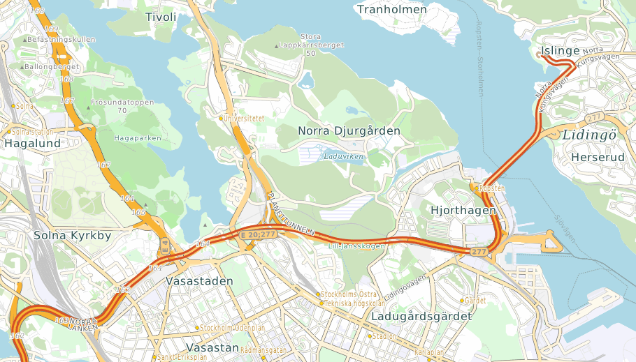
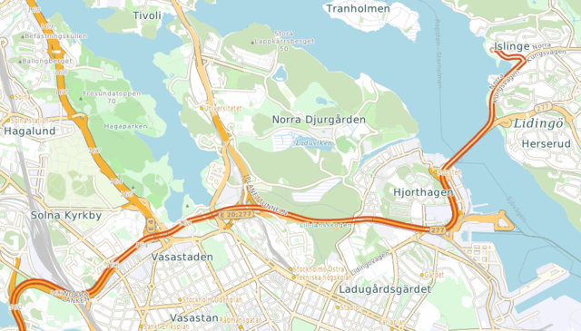
A screen shot of a map of part of Stockholm, Sweden, created using CartoType. It also shows part of a route calculated offline using CartoType.
Licensing of a new file
![]()
This media file does not have sufficient information on its copyright status. If you have created this file yourself, or the file is available under some open licence allowing its use on OSM Wiki or the file is in the public domain, you can edit the file description page to license it under one of the allowed licences. If you did not create it and it is not in the public domain, you must ask the copyright holder for permission to release it under one of the allowed licenses. Wiki:Media file license chart may be helpful to find a suitable licence.
Files without licences marked with this template are listed in Category:Media without a license or one of its subcategories. If the file is without a known open licence: ask its uploader to clarify situation or find a replacement and mark this file with {{Superseded by Commons}} and replace its uses.
Files without licences marked with this template are listed in Category:Media without a license or one of its subcategories. If the file is without a known open licence: ask its uploader to clarify situation or find a replacement and mark this file with {{Superseded by Commons}} and replace its uses.
If uploader was notified this month: use {{No licence|subcategory=uploader notified 2024, April}} - to put media into Category:Media without a license - uploader notified 2024, April and mark image as one where uploader was notified.
Licensing of the old file version
![]()
Contains map data © OpenStreetMap contributors, made available under the terms of the Creative Commons Attribution-ShareAlike 2.0 (CC-BY-SA-2.0).
File history
Click on a date/time to view the file as it appeared at that time.
| Date/Time | Thumbnail | Dimensions | User | Comment | |
|---|---|---|---|---|---|
| current | 15:01, 18 November 2020 | | 910 × 519 (143 KB) | Graham Asher (talk | contribs) | replaced very old image with a new one |
| 09:01, 19 October 2012 | 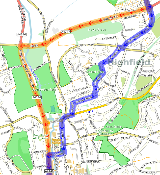 | 646 × 707 (319 KB) | Graham Asher (talk | contribs) | A screen shot of a map of part of Hemel Hempstead, Hertfordshire, England, created using CartoType. It also shows parts of two routes calculated by CartoType's routing system: the fastest route in orange, and the shortest route in blue. |
You cannot overwrite this file.