File:Christchurch parks tessellation of polygons centroids.jpg
Jump to navigation
Jump to search
Size of this preview: 800 × 462 pixels. Other resolutions: 320 × 185 pixels | 640 × 370 pixels | 1,024 × 592 pixels | 1,280 × 740 pixels | 2,487 × 1,437 pixels.
Original file (2,487 × 1,437 pixels, file size: 269 KB, MIME type: image/jpeg)
Summary
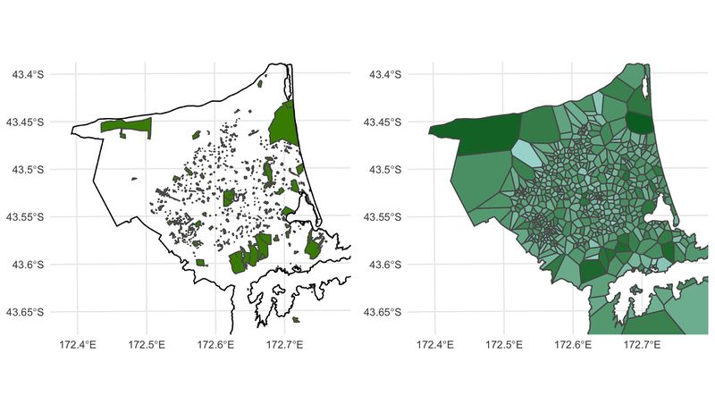
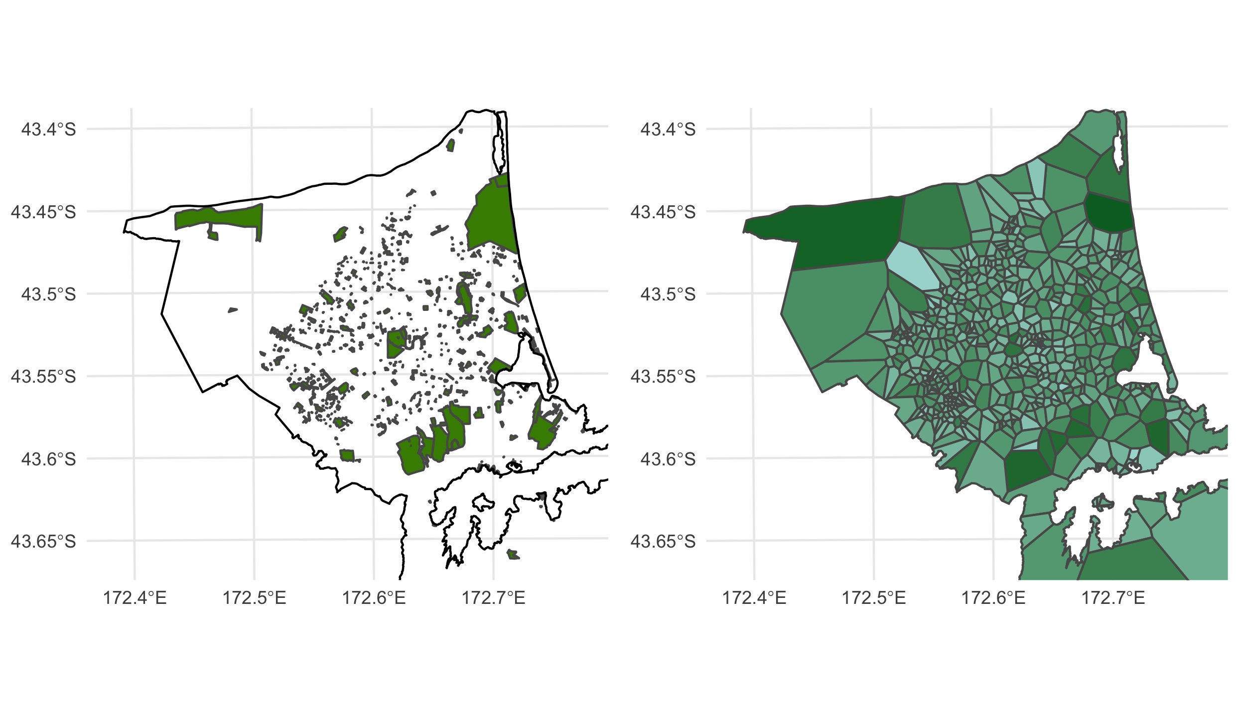
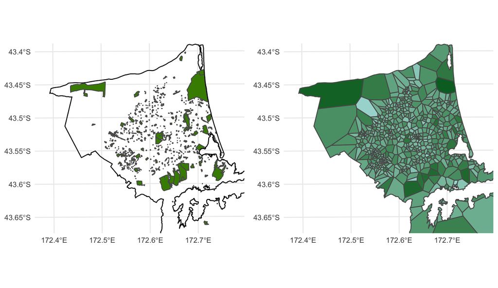
Parks in Christchurch, New Zealand. Left: park polygons, Right: tessellation of polygons centroids (catchment) while colour is log10(park area).
by Luis Apiolaza
Originally Tweeted here: https://twitter.com/zentree/status/1192519217192423425
Code: https://gist.github.com/zentree/d05f470588568c025618999b8bdf57ff
Licensing
By Luis Apiolaza. Published here CCBYSA4.0 by permission
![]()
![]()
![]()
This work is licensed under the Creative Commons Attribution-ShareAlike 4.0 License.
Attribution not specified as a parameter! THIS LICENSE ALWAYS REQUIRES ATTRIBUTION! Use {{CC-BY-SA-4.0|Attribution, typically name of author}} See Template:CC-BY-SA-4.0 for full description this template should be used.
Attribution not specified as a parameter! THIS LICENSE ALWAYS REQUIRES ATTRIBUTION! Use {{CC-BY-SA-4.0|Attribution, typically name of author}} See Template:CC-BY-SA-4.0 for full description this template should be used.
File history
Click on a date/time to view the file as it appeared at that time.
| Date/Time | Thumbnail | Dimensions | User | Comment | |
|---|---|---|---|---|---|
| current | 23:55, 24 November 2019 | | 2,487 × 1,437 (269 KB) | Harry Wood (talk | contribs) | Parks in Christchurch, New Zealand tessellation of polygons centroids (catchment) by Luis Apiolaza https://twitter.com/zentree/status/1192519217192423425 |
You cannot overwrite this file.