File:Coastline2.jpg
Jump to navigation
Jump to search

Size of this preview: 800 × 590 pixels. Other resolutions: 320 × 236 pixels | 640 × 472 pixels.
Original file (814 × 600 pixels, file size: 48 KB, MIME type: image/jpeg)
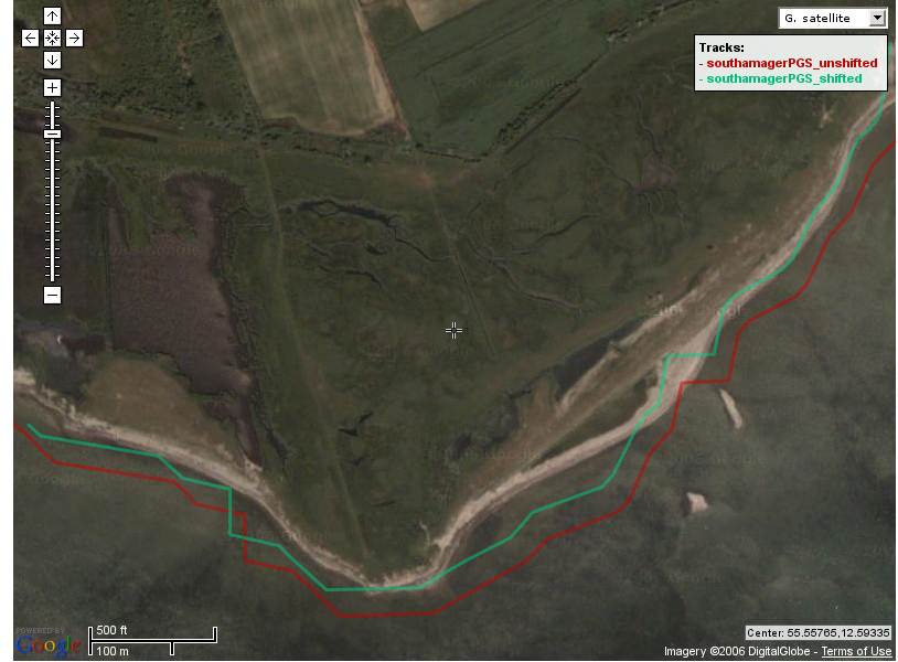
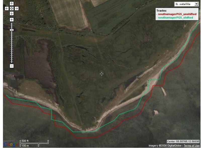
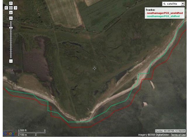
Plot of PGS coastlinedata shifted by 1 arcsecond north and 1 arcsecond west vs unshifted PGS coastlinedata on high res Digital Globe sat imagery (courtesy of GoogleMaps), to show the discrepancy which also has been verified via danish governmental cartography department (KMS) municipal geodata. Southernmost part of the Isle of Amager (Aflandshage)
File history
Click on a date/time to view the file as it appeared at that time.
| Date/Time | Thumbnail | Dimensions | User | Comment | |
|---|---|---|---|---|---|
| current | 03:03, 22 August 2006 | | 814 × 600 (48 KB) | Dutch (talk | contribs) | Plot of PGS coastlinedata shifted by 1 arcsecond north and 1 arcsecond west vs unshifted PGS coastlinedata on high res Digital Globe sat imagery (courtesy of GoogleMaps), to show the discrepancy which also has been verified via danish governmental cartogr |
You cannot overwrite this file.
File usage
The following page uses this file: