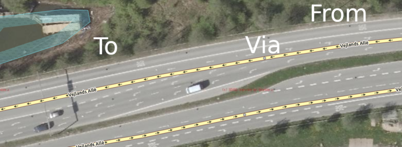
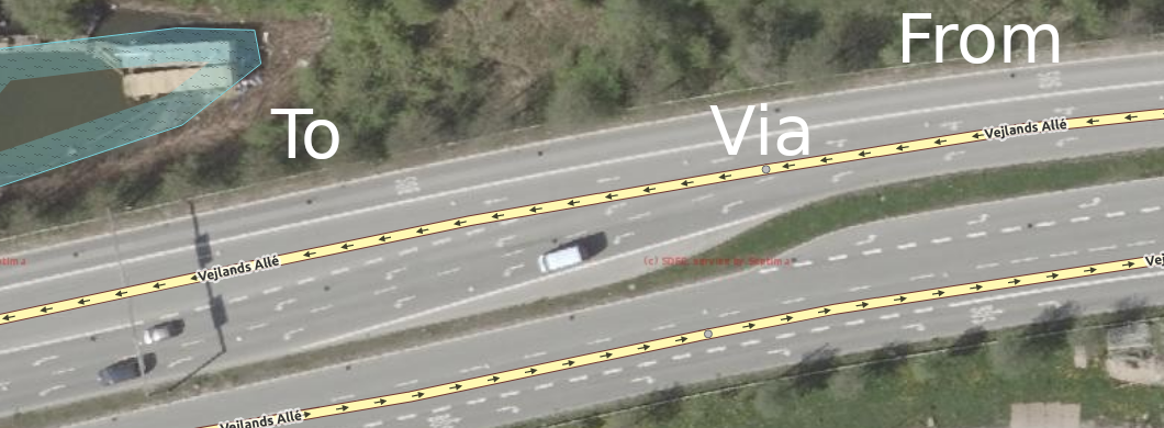
File:Complex lane connectivity Vejlands Allé.png
Jump to navigation
Jump to search
Size of this preview: 800 × 294 pixels. Other resolutions: 320 × 118 pixels | 1,060 × 390 pixels.
Original file (1,060 × 390 pixels, file size: 434 KB, MIME type: image/png)
Image from Geodatastyrelsen imagery of this location: https://www.osm.org/#map=19/55.64134/12.56093
File history
Click on a date/time to view the file as it appeared at that time.
| Date/Time | Thumbnail | Dimensions | User | Comment | |
|---|---|---|---|---|---|
| current | 16:48, 2 June 2019 | 1,060 × 390 (434 KB) | LeifRasmussen (talk | contribs) | Updated the image to have a more correct mapping style. | |
| 20:46, 24 April 2019 | 840 × 336 (377 KB) | LeifRasmussen (talk | contribs) |
You cannot overwrite this file.
File usage
The following 3 pages use this file: