File:ConsistentRailwaysZoom20.png
Jump to navigation
Jump to search

No higher resolution available.
ConsistentRailwaysZoom20.png (512 × 512 pixels, file size: 35 KB, MIME type: image/png)
Summary
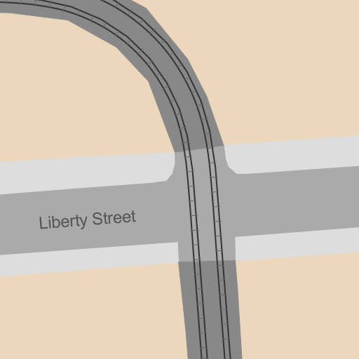
Example rendering of the "Consistent Railway Mapping" scheme at zoom 20 using the detail data. (area:railways, area:highways and some landuse for color)
In this render most of the schematic data (railways and highways) is ignored but the highways are still used to render the street names.
Licensing
![]()
This file has been released into the public domain by the copyright holder, its copyright has expired, or it is ineligible for copyright. This applies worldwide.
Please, please use more specific template such as {{PD-self}} / {{PD-creator}} / {{PD-shape}} / {{PD-USGov}} / {{PD-old}} / {{PD-RU-exempt}} ... This template is not making clear why this work is in the public domain.
Please, please use more specific template such as {{PD-self}} / {{PD-creator}} / {{PD-shape}} / {{PD-USGov}} / {{PD-old}} / {{PD-RU-exempt}} ... This template is not making clear why this work is in the public domain.
File history
Click on a date/time to view the file as it appeared at that time.
| Date/Time | Thumbnail | Dimensions | User | Comment | |
|---|---|---|---|---|---|
| current | 23:18, 13 April 2013 | | 512 × 512 (35 KB) | Mart (talk | contribs) | Example rendering of the "Consistent Railway Mapping" scheme at zoom 20 using the detail data. (area:railways, area:highways and some landuse for color) In this render most of the schematic data (railway... |
You cannot overwrite this file.
File usage
The following page uses this file: