File:Coverage-zoom-10.jpg
Jump to navigation
Jump to search


Size of this preview: 800 × 565 pixels. Other resolutions: 320 × 226 pixels | 640 × 452 pixels | 1,024 × 723 pixels | 1,280 × 904 pixels | 2,560 × 1,808 pixels | 5,280 × 3,729 pixels.
Original file (5,280 × 3,729 pixels, file size: 1.69 MB, MIME type: image/jpeg)
This is a Featured image, which means that it has been identified as one of the best examples of OpenStreetMap mapping, or that it provides a useful illustration of the OpenStreetMap project. If you know another image of similar quality, you can nominate it on Featured image proposals.
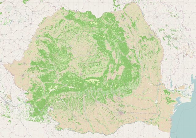
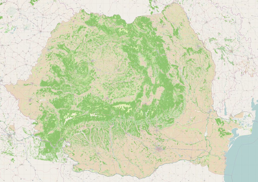
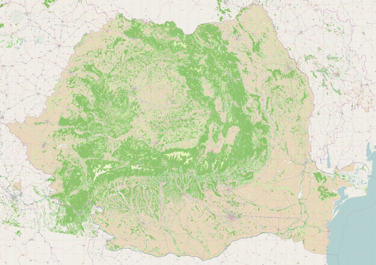
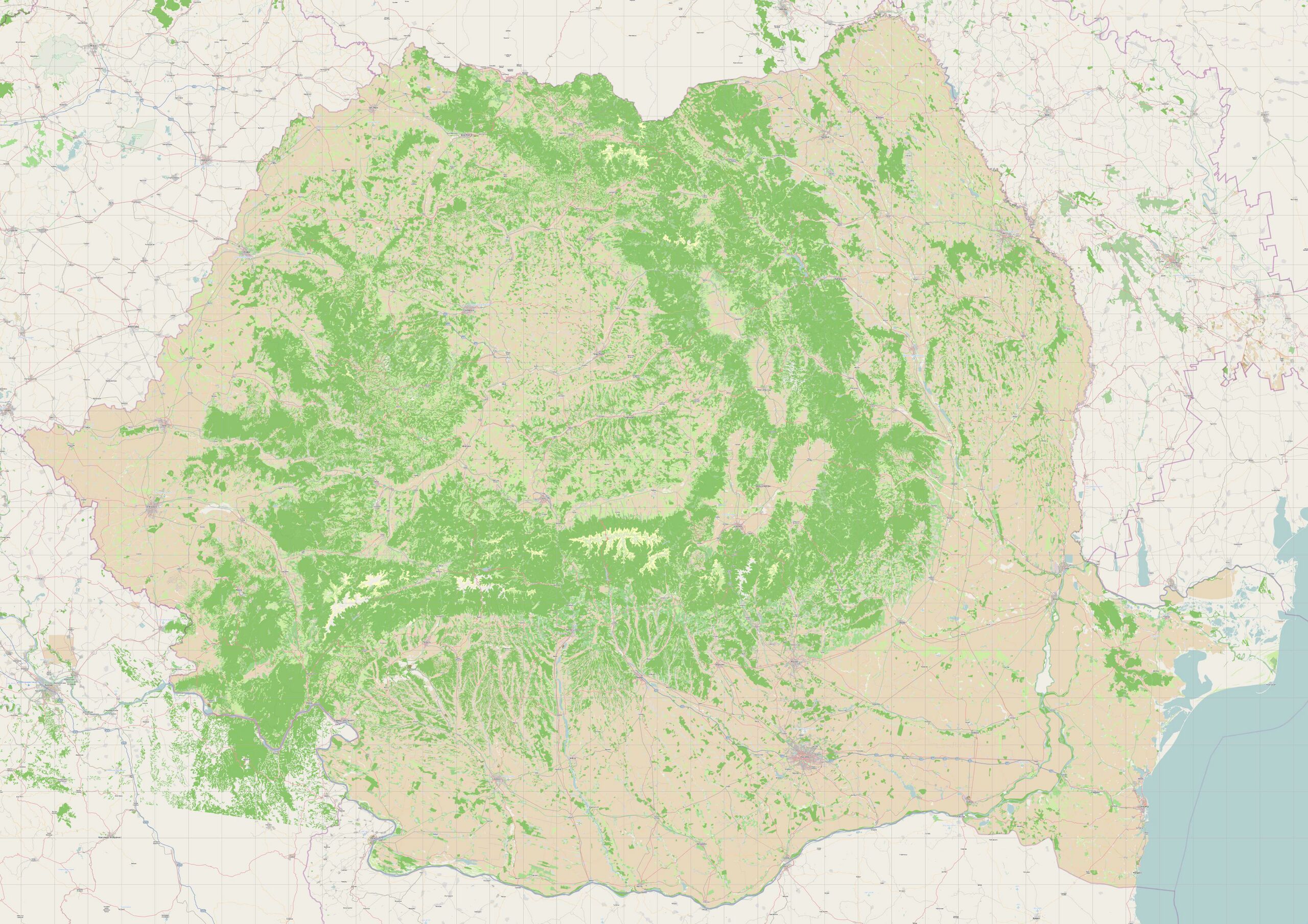
Front-page image for week 3 of 2011 (17–23 Jan.).
- Image descriptions
- Deutsch : Rumänische Landschaftsnutzung – Daten der EEA bestehend aus 100 000 Polygonen wurden im Dezember 2010 in OSM importiert.
- eesti : Rumeenia maakasutus – EEA andmed sisaldavad 100K alasid. OSMi imporditud detsembris 2010.
- English : Romanian landuse – data from EEA comprises 100K polygons, imported to OSM December 2010
- français : Utilisation des terres en Roumanie – données provenant de l'Agence Européenne pour l'Environnement et comprenant 100K polygones, importés dans OSM en décembre 2010.
- italiano : Utilizzo del terreno della Romania – i dati provenienti dalla EEA consistono in 100 mila poligoni, importati in OSM nel dicembre 2010.
- polski : Użytkowanie terenu w Rumunii – dane z EEA stanowią 100 tys. wielokątów zaimportowanych w OpenStreetMap do grudnia 2010.
File history
Click on a date/time to view the file as it appeared at that time.
| Date/Time | Thumbnail | Dimensions | User | Comment | |
|---|---|---|---|---|---|
| current | 15:38, 13 December 2010 | | 5,280 × 3,729 (1.69 MB) | Stefanu (talk | contribs) |
You cannot overwrite this file.
File usage
The following 10 pages use this file:
- Community Updates/2011-01-17
- Corine Land Cover for Romania aftermath
- Featured images/Jan-Mar 2011
- List of featured images/2011
- Template:Featured image h1
- Template:Featured image p1
- Template:Iotw image/2011-3
- DE:Featured images/Jan-Mar 2011
- FR:Featured images/Jan-Mar 2011
- IT:Featured images/Jan-Mar 2011