File:Den Haag - coverage overview.jpg
Jump to navigation
Jump to search

Size of this preview: 793 × 600 pixels. Other resolutions: 317 × 240 pixels | 635 × 480 pixels | 1,016 × 768 pixels | 1,264 × 956 pixels.
Original file (1,264 × 956 pixels, file size: 133 KB, MIME type: image/jpeg)
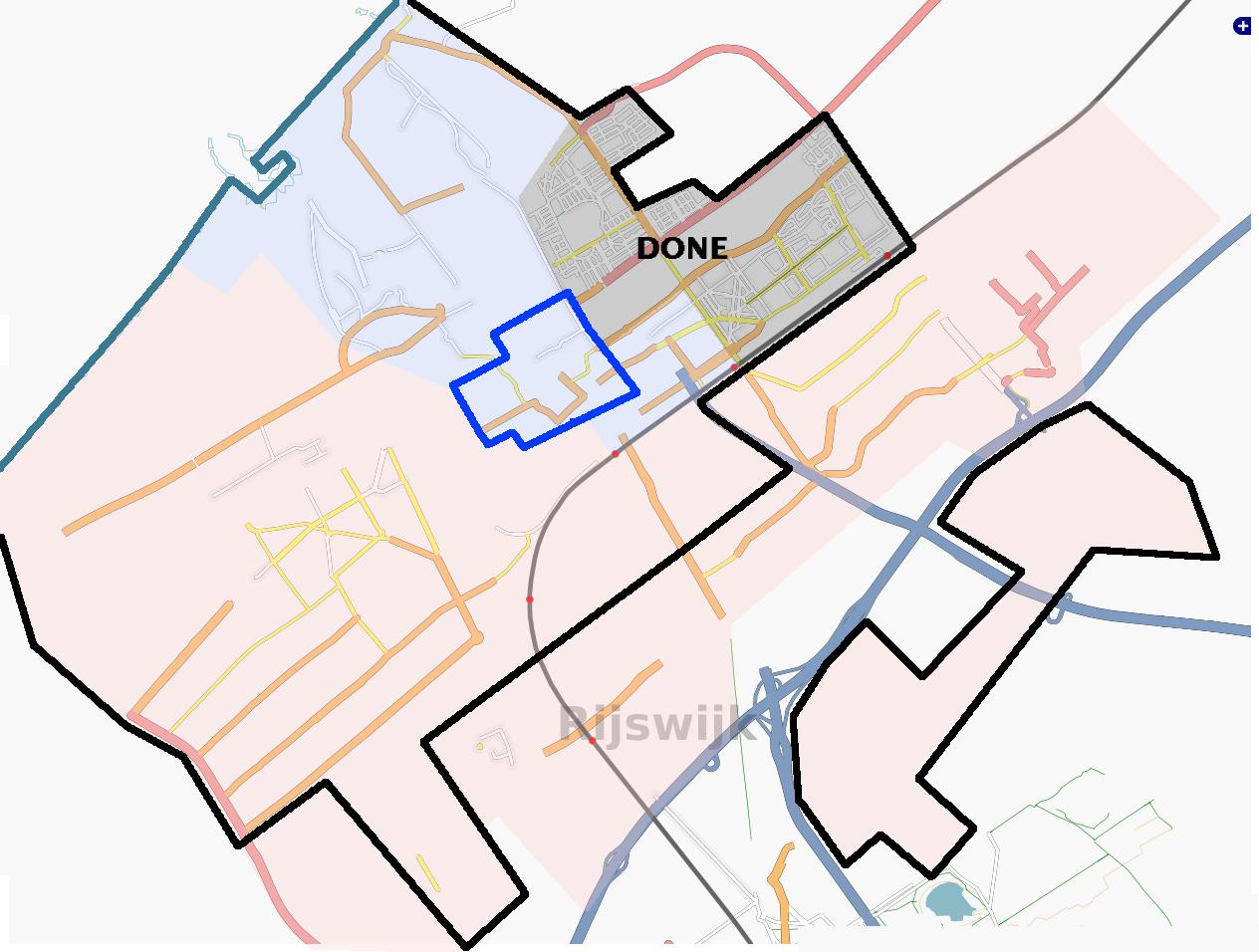
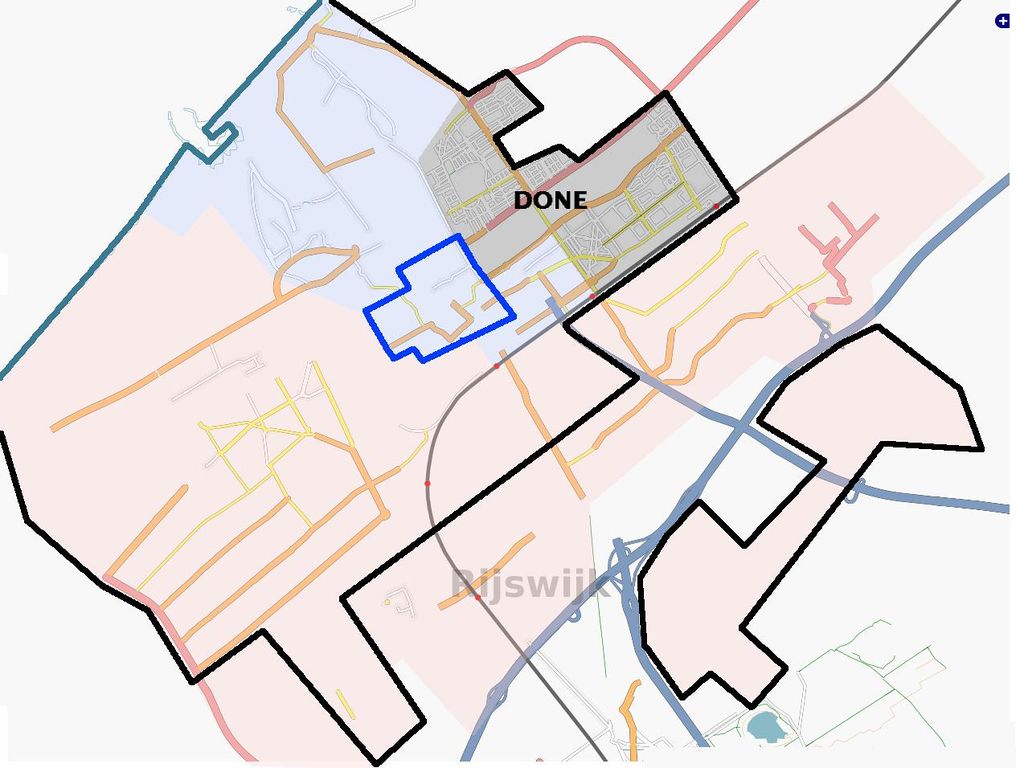
Overview of The Hague, the Netherlands.
- Red: builded area, to be mapped
- Black: The Hague city limits
- Dark blue: City centre (Singel canal)
- Grey: Already mapped
- Light blue: proposed area to be mapped at next party (see Den Haag)
Licensing
![]()
Contains map data © OpenStreetMap contributors, made available under the terms of the Creative Commons Attribution-ShareAlike 2.0 (CC-BY-SA-2.0).
File history
Click on a date/time to view the file as it appeared at that time.
| Date/Time | Thumbnail | Dimensions | User | Comment | |
|---|---|---|---|---|---|
| current | 23:16, 8 April 2007 | | 1,264 × 956 (133 KB) | Eugene van der Pijll (talk | contribs) | Overview of The Hague, the Netherlands. * Red: builded area, to be mapped * Black: The Hague city limits * Dark blue: City centre (''Singel'' canal) * Grey: Already mapped * Light blue: proposed area to be mapped at next party (see Den Haag) |
You cannot overwrite this file.
File usage
There are no pages that use this file.