File:Denmark coverage heatmap example.jpg
Jump to navigation
Jump to search

No higher resolution available.
Denmark_coverage_heatmap_example.jpg (583 × 451 pixels, file size: 123 KB, MIME type: image/jpeg)
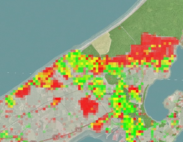
Example of heat map of coverage of streets as opposed to address nodes.
The heap map of Denmark is based on whether the addr:street=* names in address nodes in the area also have similar named roads in the vicinity. Red areas indicate lots of address nodes without corresponding ways.
Source: http://osm.rasher.dk/?zoom=12&lat=55.96215&lon=12.06699&layers=B000FTFFFFFFFFFT , created by user Rasher
![]()
Contains map data © OpenStreetMap contributors, made available under the terms of the Creative Commons Attribution-ShareAlike 2.0 (CC-BY-SA-2.0).
File history
Click on a date/time to view the file as it appeared at that time.
| Date/Time | Thumbnail | Dimensions | User | Comment | |
|---|---|---|---|---|---|
| current | 02:58, 17 January 2011 | | 583 × 451 (123 KB) | Findvej (talk | contribs) | Example of heat map of coverage of streets as opposed to address nodes. The heap map of Denmark is based on whether the {{Key|addr:street}} names in address nodes in the area also have similar named roads in the vicinity. Red areas indicate lots of a |
You cannot overwrite this file.