File:Designation ito.png
Jump to navigation
Jump to search


Size of this preview: 800 × 389 pixels. Other resolutions: 320 × 156 pixels | 853 × 415 pixels.
Original file (853 × 415 pixels, file size: 210 KB, MIME type: image/png)
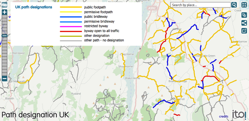
Paths with a "designation" key visualised on an ITO Map. However when ITO World first started delivering tools for OpenStreetMap (OSM), there were very few options on the market. Since that time, many new tools and companies have focused on serving the OSM community. As a result, Ito World has decided to withdraw the ITO Map service.
File history
Click on a date/time to view the file as it appeared at that time.
| Date/Time | Thumbnail | Dimensions | User | Comment | |
|---|---|---|---|---|---|
| current | 17:00, 15 May 2012 | | 853 × 415 (210 KB) | RobJN (talk | contribs) | Paths with a "designation" key visualised on an [http://www.itoworld.com/map/87#fullscreen ITO World map]. |
You cannot overwrite this file.
File usage
The following page uses this file: