File:Diagram of Embankment.png
Jump to navigation
Jump to search

Size of this preview: 800 × 182 pixels. Other resolutions: 320 × 73 pixels | 1,265 × 287 pixels.
Original file (1,265 × 287 pixels, file size: 18 KB, MIME type: image/png)
Summary
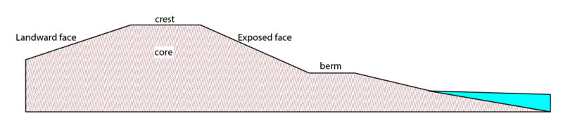
| Description | Diagram of an Embankment |
|---|---|
| Author | |
| Source | Department for Environment Food & Rural Affairs |
| Date | 29/07/2020 |
Licensing

The copyright holder of this file allows anyone to use it for any purpose, provided that the copyright holder is properly attributed. Redistribution, derivative work, commercial use, and all other use is permitted.
If you are the uploader, please provide proper attribution including source and name of author.
If you are the uploader, please provide proper attribution including source and name of author.
File history
Click on a date/time to view the file as it appeared at that time.
| Date/Time | Thumbnail | Dimensions | User | Comment | |
|---|---|---|---|---|---|
| current | 23:20, 17 January 2023 | 1,265 × 287 (18 KB) | Multimodaal (talk | contribs) | {{Information | description= Diagram of an Embankment | source=Department for Environment Food & Rural Affairs | date=29/07/2020 | author= | other_versions= | license=Open Government Licence v3.0 }} |
You cannot overwrite this file.
File usage
The following 3 pages use this file: