File:Dissolve.png
Jump to navigation
Jump to search

Size of this preview: 752 × 599 pixels. Other resolutions: 301 × 240 pixels | 602 × 480 pixels | 964 × 768 pixels | 1,280 × 1,020 pixels | 1,497 × 1,193 pixels.
Original file (1,497 × 1,193 pixels, file size: 334 KB, MIME type: image/png)
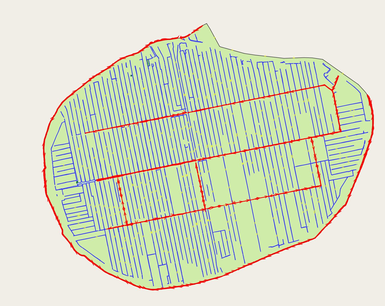
Example of the dissolving, keeping primary waters (red) and secundary waters (blue) apart, but joining the identical areas within these categories as to reduce the amaount of data and the number of members of the multipolygon, while keeping the seperate areas managable in shape and number of nodes
Licensing
![]()
![]()
![]()
This work is licensed under the Creative Commons Attribution-ShareAlike 4.0 License.
Attribution not specified as a parameter! THIS LICENSE ALWAYS REQUIRES ATTRIBUTION! Use {{CC-BY-SA-4.0|Attribution, typically name of author}} See Template:CC-BY-SA-4.0 for full description this template should be used.
Attribution not specified as a parameter! THIS LICENSE ALWAYS REQUIRES ATTRIBUTION! Use {{CC-BY-SA-4.0|Attribution, typically name of author}} See Template:CC-BY-SA-4.0 for full description this template should be used.
File history
Click on a date/time to view the file as it appeared at that time.
| Date/Time | Thumbnail | Dimensions | User | Comment | |
|---|---|---|---|---|---|
| current | 19:52, 1 March 2018 | | 1,497 × 1,193 (334 KB) | Multimodaal (talk | contribs) |
You cannot overwrite this file.
File usage
The following page uses this file: