File:Duesseldorf-Stadtbezirk8.png
Jump to navigation
Jump to search

No higher resolution available.
Duesseldorf-Stadtbezirk8.png (666 × 480 pixels, file size: 477 KB, MIME type: image/png)
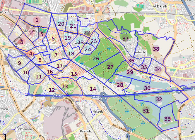
Divison of Düsseldorf's Stadtbezirk 8 into 38 parts. Used for quality proof and a more accurate status.
Licensing
![]()
![]()
![]()
This screenshot contains OpenStreetMap Carto rendering.
The OpenStreetMap Carto map style is made available under the Creative Commons CC-0 1.0 Universal Public Domain Dedication.
- Attribution to the map data:
![]()
Contains map data © OpenStreetMap contributors, made available under the terms of the Creative Commons Attribution-ShareAlike 2.0 (CC-BY-SA-2.0).
File history
Click on a date/time to view the file as it appeared at that time.
| Date/Time | Thumbnail | Dimensions | User | Comment | |
|---|---|---|---|---|---|
| current | 09:05, 12 September 2009 | | 666 × 480 (477 KB) | E-Malte (talk | contribs) | Divison of Düsseldorf's Stadtbezirk 8 into 38 parts. Used for quality proof and a more accurate status. |
You cannot overwrite this file.
File usage
The following 2 pages use this file: