File:Dyke-Floodgate.jpg
Jump to navigation
Jump to search


Size of this preview: 800 × 600 pixels. Other resolutions: 320 × 240 pixels | 640 × 480 pixels | 1,024 × 768 pixels | 1,280 × 960 pixels | 2,560 × 1,920 pixels.
Original file (2,560 × 1,920 pixels, file size: 984 KB, MIME type: image/jpeg)
Summary
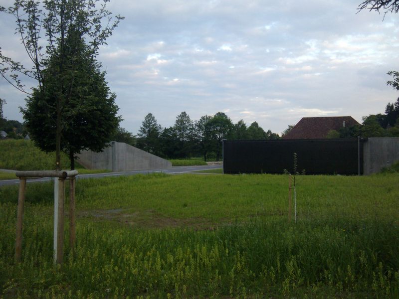
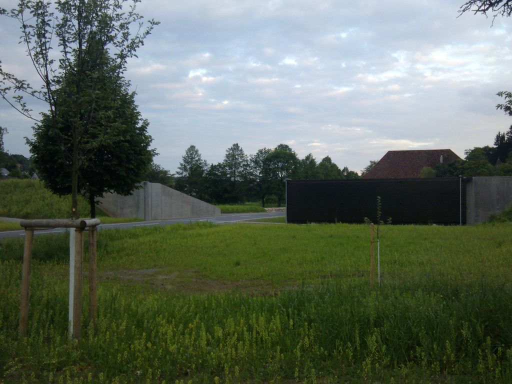
This image shows a floodgate which is built into a dyke to allow a road to cross the dyke straight through.
This is part of the Dyke which was built 2011 at http://www.openstreetmap.org/?lat=48.535858&lon=9.077078&zoom=18&layers=M
Licensing
- This media file was uploaded by author of the work and its copyright holder.
![]()
![]()
![]()
This work is licensed under the Creative Commons Attribution-ShareAlike 2.0 License.
Attribution: Eliasp
Attribution: Eliasp
File history
Click on a date/time to view the file as it appeared at that time.
| Date/Time | Thumbnail | Dimensions | User | Comment | |
|---|---|---|---|---|---|
| current | 02:02, 28 May 2012 | | 2,560 × 1,920 (984 KB) | Eliasp (talk | contribs) | This image shows a floodgate which is built into a dyke to allow a road to cross the dyke straight through. This is part of the Dyke which was built 2011 at http://www.openstreetmap.org/?lat=48.535858&lon=9.077078&zoom=18&layers=M |
You cannot overwrite this file.
File usage
The following page uses this file: