File:EA highway trunk.jpg
Jump to navigation
Jump to search


Size of this preview: 800 × 543 pixels. Other resolutions: 320 × 217 pixels | 640 × 434 pixels | 1,024 × 695 pixels | 1,280 × 868 pixels | 2,500 × 1,696 pixels.
Original file (2,500 × 1,696 pixels, file size: 570 KB, MIME type: image/jpeg)
Summary
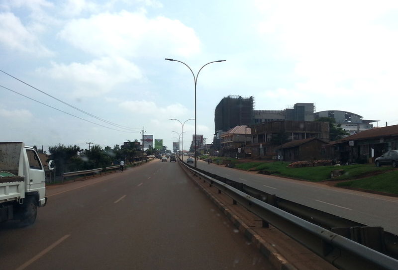
An example for a trunk road in East Africa. This picture shows the Kampala-Entebbe-Highway between Katwe and Zana in Uganda.
Licensing
![]()
I, the creator of this work, hereby release it into the public domain. This applies worldwide.
In case this is not legally possible, I grant anyone the right to use this work for any purpose, without any conditions, unless such conditions are required by law.
Notice to creator or uploader: Please consider using {{CC0-self}} instead for your work.
"Releasing work to public domain" has some issues, as it is not well defined in some jurisdictions and/or it is not actually possible to "release to public domain". Using CC0 license achieves the intended effect while avoiding such problems and is well suited for media files.
File history
Click on a date/time to view the file as it appeared at that time.
| Date/Time | Thumbnail | Dimensions | User | Comment | |
|---|---|---|---|---|---|
| current | 18:21, 19 June 2015 | | 2,500 × 1,696 (570 KB) | Jotam (talk | contribs) | An example for a trunk road in East Africa. This picture shows the Kampala-Entebbe-Highway between Katwe and Zana in Uganda. |
You cannot overwrite this file.
File usage
The following 12 pages use this file:
- Cs:East Africa Tagging Guidelines
- Cs:Highway Tag Africa
- East Africa Tagging Guidelines
- Highway Tag Afghanistan
- Highway Tag Africa
- Papua New Guinea Tagging Guidelines
- User:Sunfishtommy
- Template:Africa highways table
- Template:Cs:Tabulka afrických silnic
- Template:Cs:Tabulka východoafrických silnic
- DE:Highway Tag Africa
- JA:Highway Tag Africa