File:Erbil.jpg
Jump to navigation
Jump to search

Size of this preview: 509 × 599 pixels. Other resolutions: 204 × 240 pixels | 408 × 480 pixels | 874 × 1,029 pixels.
Original file (874 × 1,029 pixels, file size: 238 KB, MIME type: image/jpeg)
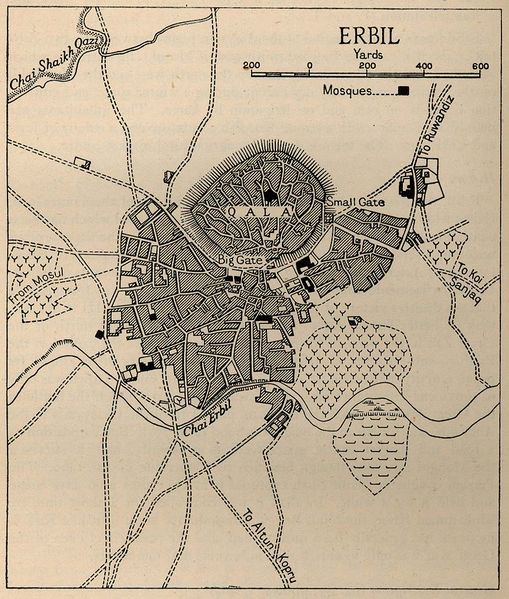
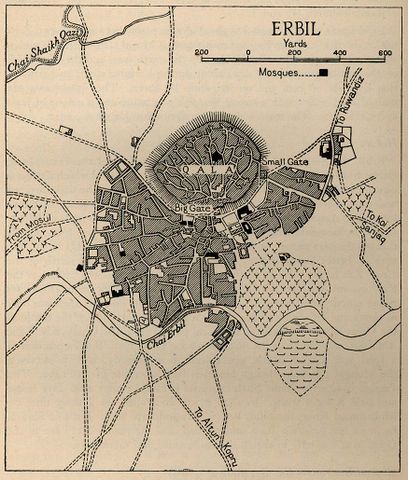
Old map of Erbil. This map shows the city of Erbil (it is referred to it as Hawler in Kurdish) at least before the fall of the Ottoman. The writings on the map are in English and Kurdish. For example the old castle of Erbil is written as Qala meaning castle. This castle is very old and it is located in the city centre of Hawler.
File history
Click on a date/time to view the file as it appeared at that time.
| Date/Time | Thumbnail | Dimensions | User | Comment | |
|---|---|---|---|---|---|
| current | 13:44, 28 August 2010 | | 874 × 1,029 (238 KB) | Soran (talk | contribs) | Old map of Erbil |
You cannot overwrite this file.
File usage
The following page uses this file: