File:Examples of peninsulas.png
Jump to navigation
Jump to search

Size of this preview: 624 × 599 pixels. Other resolutions: 250 × 240 pixels | 500 × 480 pixels | 703 × 675 pixels.
Original file (703 × 675 pixels, file size: 260 KB, MIME type: image/png)
Summary
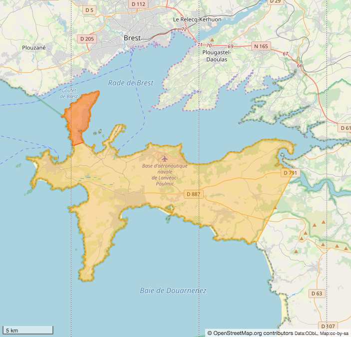
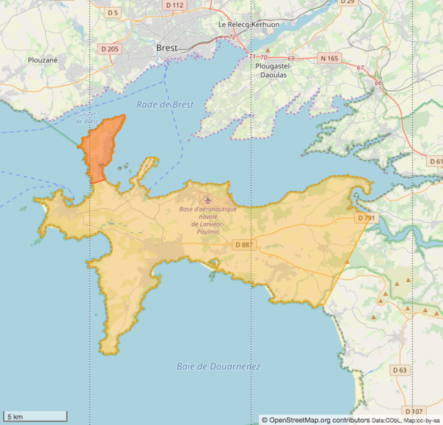
A peninsula (Presqu'île de Roscanvel; dark orange) that is part of another peninsula (Presqu'île de Crozon; light orange)
Location: https://www.openstreetmap.org/#map=11/48.2700/-4.4500
Licensing
| Contains map data © OpenStreetMap contributors, made available under the terms of the Open Database License (ODbL).
The ODbL does not require any particular license for maps produced from ODbL data, produced maps may be subject also to other licences. |
File history
Click on a date/time to view the file as it appeared at that time.
| Date/Time | Thumbnail | Dimensions | User | Comment | |
|---|---|---|---|---|---|
| current | 16:51, 27 January 2019 | | 703 × 675 (260 KB) | SelfishSeahorse (talk | contribs) | A peninsula (Presqu'île de Roscanvel; red) that is part of another peninsula (Presqu'île de Crozon; orange) Location: https://www.openstreetmap.org/#map=11/48.2700/-4.4500 |
You cannot overwrite this file.
File usage
The following 4 pages use this file: