File:FacilMap.png
Jump to navigation
Jump to search

Size of this preview: 800 × 450 pixels. Other resolutions: 320 × 180 pixels | 640 × 360 pixels | 1,024 × 576 pixels | 1,280 × 720 pixels | 1,920 × 1,080 pixels.
Original file (1,920 × 1,080 pixels, file size: 3.72 MB, MIME type: image/png)
Summary
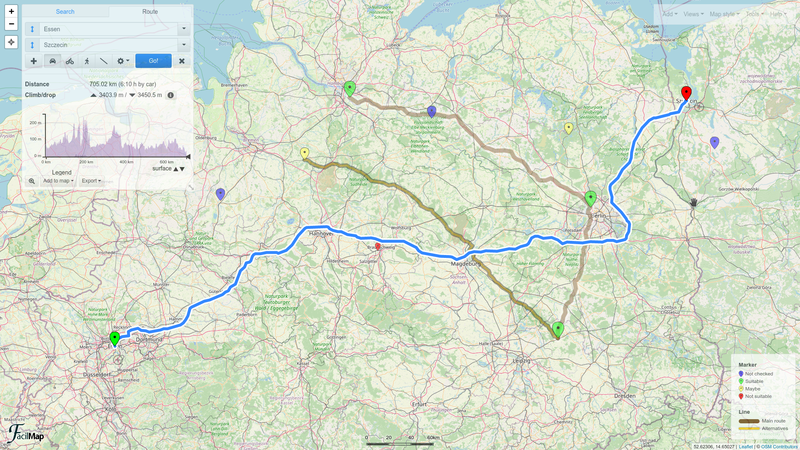
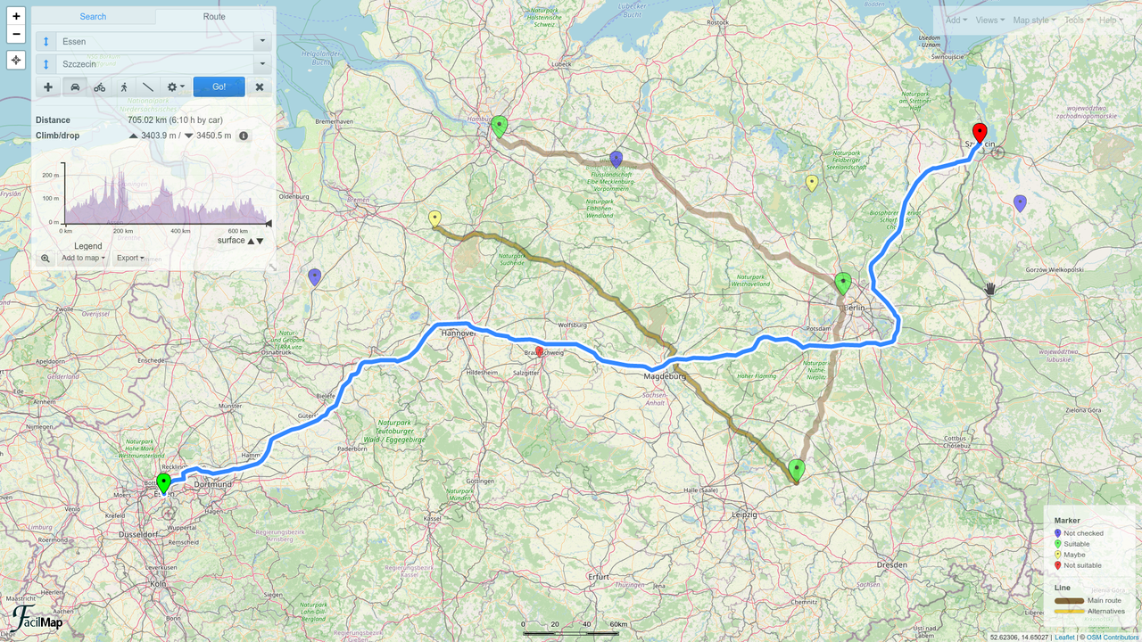
FacilMap (FacilMap.org) in the edit "collaborative map" mode: a route and its elevation profile has been calculated on top of a map that contains various markers and lines, with a legend explaining the meaning of the different colours.
Licensing
| Contains map data © OpenStreetMap contributors, made available under the terms of the Open Database License (ODbL).
The ODbL does not require any particular license for maps produced from ODbL data, produced maps may be subject also to other licences. |
![]()
![]()
![]()
This work is licensed under the Creative Commons Attribution-ShareAlike 3.0 License.
Attribution not specified as a parameter! THIS LICENSE ALWAYS REQUIRES ATTRIBUTION! Use {{CC-BY-SA-3.0|Attribution, typically name of author}} See Template:CC-BY-SA-3.0 for full description how this template should be used.
Attribution not specified as a parameter! THIS LICENSE ALWAYS REQUIRES ATTRIBUTION! Use {{CC-BY-SA-3.0|Attribution, typically name of author}} See Template:CC-BY-SA-3.0 for full description how this template should be used.
File history
Click on a date/time to view the file as it appeared at that time.
| Date/Time | Thumbnail | Dimensions | User | Comment | |
|---|---|---|---|---|---|
| current | 14:09, 10 April 2021 | | 1,920 × 1,080 (3.72 MB) | Candid Dauth (talk | contribs) | |
| 16:57, 10 May 2019 |  | 1,831 × 991 (1.27 MB) | PARTYFAN (talk | contribs) | FacilMap.org in the edit "collaborative map" mode:a kml file has been loaded, a kml linear feature has been added to the map and a Line object was drawn on the map |
You cannot overwrite this file.
File usage
The following 3 pages use this file: