File:False ruin.png
Jump to navigation
Jump to search

Size of this preview: 800 × 440 pixels. Other resolutions: 320 × 176 pixels | 640 × 352 pixels | 1,024 × 563 pixels | 1,280 × 704 pixels | 1,920 × 1,056 pixels.
Original file (1,920 × 1,056 pixels, file size: 1.53 MB, MIME type: image/png)
Summary
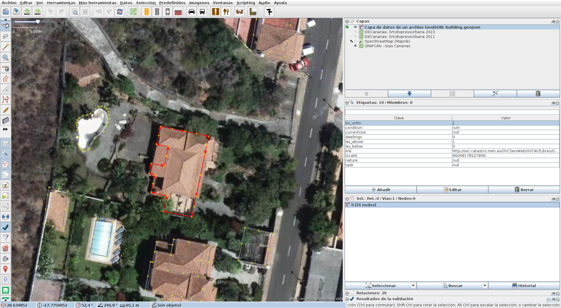
Atributos incorrectos en la importación de edificios de Catastro.
El edificio señalado en esta foto tiene el valor 'ruin' en el campo 'condtion', es decir condición ruinosa. Sin embargo, en la foto aérea y en esta foto de fachada vemos que no es así.
Licensing
![]()
This file is a screenshot of the software JOSM, with imagery in background. It may include OpenStreetMap data, in such case ODbL license also applies.
![]()
"JOSM" (Java OpenStreetMap Editor – josm.openstreetmap.de) is free software released under the terms of the GNU General Public License as published by the Free Software Foundation; either version 2 of the license, or any later version.
License of imagery not specified! [→ template]
Data displayed: minimalFile history
Click on a date/time to view the file as it appeared at that time.
| Date/Time | Thumbnail | Dimensions | User | Comment | |
|---|---|---|---|---|---|
| current | 18:52, 5 December 2017 | | 1,920 × 1,056 (1.53 MB) | Javiersanp (talk | contribs) | Atributos incorrectos en la importación de edificios de Catastro. El edificio señalado en esta foto tiene el valor 'ruin' en el campo 'condtion', es decir condición ruinosa. Sin embargo, en... |
You cannot overwrite this file.
File usage
The following 2 pages use this file: