File:FastDraw demo.jpg
Original file (1,336 × 1,040 pixels, file size: 575 KB, MIME type: image/jpeg)
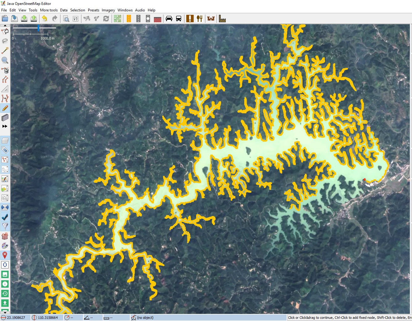
Example of using the FastDraw plugin to trace a complicated geometry
Licensing
![]()
![]()
Imagery in background: see below
Data displayed: noneThis image contains data from a satellite in the Copernicus Programme, such as Sentinel-1, Sentinel-2 or Sentinel-3. Attribution is required when using this image. Attribution: Contains modified Copernicus Sentinel data (2017)
(see also https://commons.wikimedia.org/wiki/Template:Attribution-Copernicus/en )
This image contains data from a satellite in the Copernicus Programme, such as Sentinel-1, Sentinel-2 or Sentinel-3. Attribution is required when using this image.
Contains modified Copernicus Sentinel data {{{year}}}
The use of Copernicus Sentinel Data is regulated under EU law (Commission Delegated Regulation (EU) No 1159/2013 and Regulation (EU) No 377/2014). Relevant excerpts:
- Financial conditions
Free access shall be given to GMES dedicated data [...] made available through GMES dissemination platforms [...].
- Conditions regarding use
Access to GMES dedicated data [...] shall be given for the purpose of the following use in so far as it is lawful:
- reproduction;
- distribution;
- communication to the public;
- adaptation, modification and combination with other data and information;
- any combination of points (a) to (d).
GMES dedicated data [...] may be used worldwide without limitations in time.
- Conditions regarding information to be given by users
- When distributing or communicating GMES dedicated data [...] to the public, users shall inform the public of the source of that data and information.
- Users shall make sure not to convey the impression to the public that the user’s activities are officially endorsed by the Union.
- Where that data or information has been adapted or modified, the user shall clearly state this.
- Absence of warranty
GMES dedicated data and GMES service information are provided to users without any express or implied warranty, including as regards quality and suitability for any purpose.
File history
Click on a date/time to view the file as it appeared at that time.
| Date/Time | Thumbnail | Dimensions | User | Comment | |
|---|---|---|---|---|---|
| current | 08:33, 19 October 2017 | | 1,336 × 1,040 (575 KB) | Ff5722 (talk | contribs) | Example of using the FastDraw plugin to trace a complicated geometry |
You cannot overwrite this file.
File usage
The following 4 pages use this file: