File:Fire station-type.svg

Original file (SVG file, nominally 1,080 × 640 pixels, file size: 26 KB)
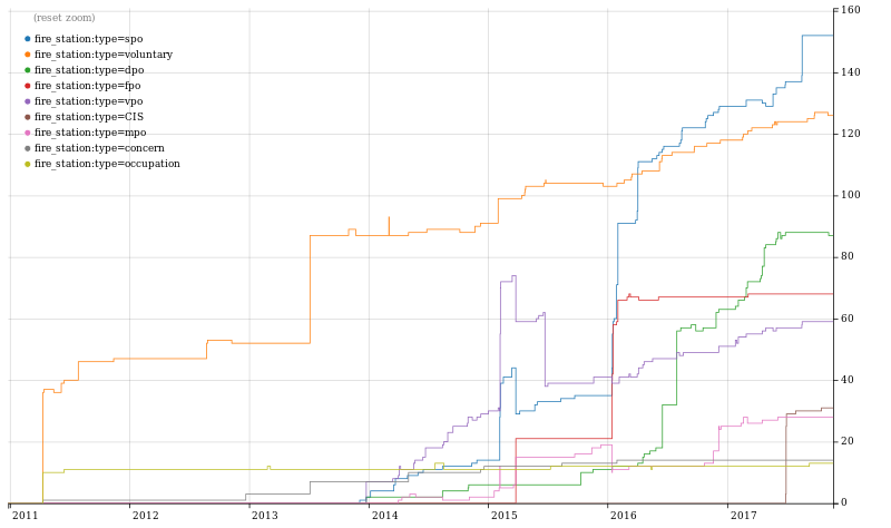
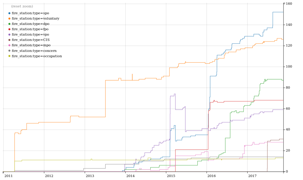
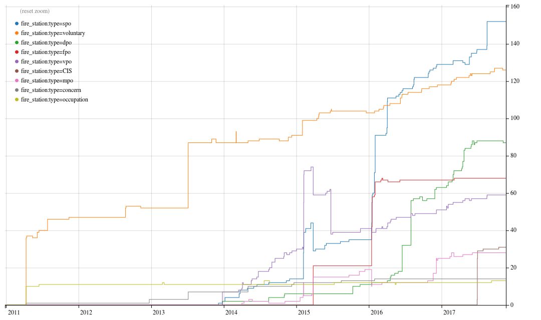
Taghistory of the development of fire_station:type=* tags.
This graph was made with the OSM Tag History tool.
Click here for the interactive graph: https://taghistory.raifer.tech/#***/fire_station%3Atype/spo&***/fire_station%3Atype/voluntary&***/fire_station%3Atype/dpo&***/fire_station%3Atype/fpo&***/fire_station%3Atype/vpo&***/fire_station%3Atype/CIS&***/fire_station%3Atype/mpo&***/fire_station%3Atype/concern&***/fire_station%3Atype/occupation
Licensing
| Contains map data © OpenStreetMap contributors, made available under the terms of the Open Database License (ODbL).
The ODbL does not require any particular license for maps produced from ODbL data, produced maps may be subject also to other licences. |
File history
Click on a date/time to view the file as it appeared at that time.
| Date/Time | Thumbnail | Dimensions | User | Comment | |
|---|---|---|---|---|---|
| current | 14:17, 28 February 2018 | | 1,080 × 640 (26 KB) | FredrikLindseth (talk | contribs) |
You cannot overwrite this file.
File usage
The following page uses this file: